|
©The Archaeological Settlements of Turkey - TAY Project
|
|
|
|
|
|
Kayaardi Tepesi |
|
|
For site maps and drawings please click on the picture... 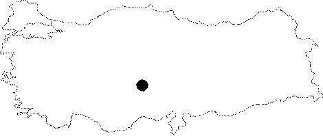 |
For photographs please click on the photo... 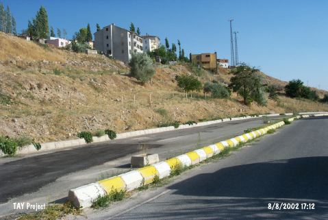 |
|
Type:
|
Artifact Scatter |
|
Altitude:
|
1330 m |
|
Region:
|
Central Anatolia |
|
Province:
|
Nigde |
|
District:
|
Merkez |
|
Village:
|
Merkez |
|
Investigation Method:
|
Survey |
|
Period:
|
Ceramic |
|
|
|
 |
|
| Location: The site lies at Kayaardi Mevkii; on a terrace 2.4 km northwest of the city of Nigde; in an area that overlooks the city. It is also known as Kisla Kadarak. |
| Geography and Environment: Mount Kayaardi is 1 km long; flat and rocky. In 1967 when Todd was researching the area; he noted that Mount Kayaardi in entirety would very shortly be completely covered by modern development. The road that goes from Nigde to Yesilburç is built along side the water pipelines. Finds were found scattered on and around the rocky hill. The thickness of the depositional fill is not known. In many places; bedrock is still at the surface. |
| History: |
| Research and Excavation: The site was discovered by Güner Soylu. In addition to Soylu; Todd conducted a surface survey at the site in 1966. |
| Stratigraphy: The ceramic finds yielded by the surface surveys suggest that the site was used not only in the Neolithic but in the Early Bronze Age II as well. |
| Small Finds: Pottery: Only a few Neolithic ceramics were found. Chipped Stone: The systematic survey at the site yielded a total of 3;633 chipped stone fragments. 95 of these were pressure flaked points; 83 were scrapers on flakes while the rest were burins; perforators; cores and blades. |
| Remains: |
| Interpretation and Dating: In ASPRO; the site has been dated between 8;000 BP and 7;600 BP The density of chipped stone tools suggests that the site was used as a habitation area; in addition to being a workshop. |