|
©The Archaeological Settlements of Turkey - TAY Project
|
|
|
|
|
|
Kargalo Tepesi |
|
|
For site maps and drawings please click on the picture...  |
For photographs please click on the photo... 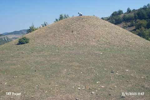 |
|
Type:
|
Mound |
|
Altitude:
|
865 m |
|
Region:
|
Black Sea |
|
Province:
|
Sinop |
|
District:
|
Gerze |
|
Village:
|
Tilkilik |
|
Investigation Method:
|
Survey |
|
Period:
|
|
|
|
|
 |
|
| It lies to the west-northwest of the village of Sarimsak; northwest of Hirmancik Hill; north of Elmadag Hill; on the western bank of the Sarimsak Stream; immediate south of Tilkilik Village; south of Gerze District of Sinop Province. It was discovered during the Sinop Survey conducted by M.A. Isin. It measures 4-5 m in height and 50 m in width. Poor number of materials collected is dated to the EBA and the second millennium BC. The EBA pottery is largely of red and black burnished ware with a plant; grit and seashell tempered paste. It takes place in the registered archaeological sites list prepared by Ministry of Culture and Tourism. |
| Location: |
| Geography and Environment: |
| History: |
| Research and Excavation: |
| Stratigraphy: |
| Small Finds: |
| Remains: |
| Interpretation and Dating: |