|
©The Archaeological Settlements of Turkey - TAY Project
|
|
|
|
|
|
Karaz |
|
|
For site maps and drawings please click on the picture... 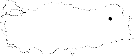 |
For photographs please click on the photo...  |
|
Type:
|
Mound |
|
Altitude:
|
1800 m |
|
Region:
|
Eastern Anatolia |
|
Province:
|
Erzurum |
|
District:
|
Merkez |
|
Village:
|
Karaz |
|
Investigation Method:
|
Excavation |
|
Period:
|
Late |
|
|
|
 |
|
| Location: It is located to the village of Karaz (Karamanlar); 5 km north of the Ilica Sub-District; about 16 km west-northwest of the Erzurum Province [Kosay-Turfan 1959:349]. |
| Geography and Environment: It is a medium sized mound; 16 m in height and ca. 20 m in diameter. It has been completely obscured by the houses of the modern village [Kosay-Turfan 1959:map.2]. Southern part faces the plain irrigated by the Karasu Stream. It is surrounded by a fertile land suitable both for cropping and pasture. It has been severely damaged by the local villagers who removed soil and stones from the mound. Leaders of the excavation claim that no good results can be obtained from the upper levels. To the south lies another flat hill; probably consisting of remains of a late period which this exposes that the mound has more than one core. |
| History: |
| Research and Excavation: Since it was near the province and severely damaged; it was given priority for excavation among other mounds like Sos and Tepecik located in the Erzurum Plain. It was introduced by H. Örs in 1941; and excavated under H.Z. Kosay and K. Turfan in 1942 and 1944 rather like a sounding opened in three places called clefts A; B and C. Although stepped trench B; 15x50 m in dimensions on the top hill yielded the stratification; no exact results were obtained due to the insufficiency of the excavation. Erzurum Plain is thought to be filled in time with the alluvium of Karasu. It takes place in the registered archaeological sites list prepared by Ministry of Culture and Tourism. |
| Stratigraphy: The stratigraphy of Karaz Mound is not very clear. According to the reports; EBA level is below the 1.5 m thick Byzantine Level. Directors of the excavation claim that the 2.5 m thick sterile yellow earth layer; at the 11th stage below the EBA Level in Trench B1; seperates the EBA Level and the Chalcolithic Age Level. This yellow soil is observed to be not covering the entire trench as is obvious in the section drawings. The existence of a burnt level is reported at the 14th stage; approximately 9-10 m deep. |
| Small Finds: Architecture: The Late Chalcolithic Age levels are interpretated to be below the thick yellow earth; in which no finds were found and is thought to be brought from outside. Although there are no architectural remains reported; mud-brick wall remains are observed at the section drawings [Kosay-Turfan 1959:plan 3]. Ceramics: Excavators report that wide band relief decorated or fluted red / black-faced sherds were recovered between the 12-15th Stages; in the Late Chalcolithic Age levels [Kosay-Turfan 1959]. Chipped Stone: Obsidian blades are dominant. Metal: Finds are reported to be rare. |
| Remains: |
| Interpretation and Dating: The stratigraphy of Karaz is a problem. The lower levels of the mound date to the EBA 1 according to many archaeologists. The recovery of wares; named as "Karaz ware"; stratigraphically in the Late Chalcolithic Age; in Elazig Region; suggests that such pottery was existent since the end of the 4th Millennium BC in Eastern Anatolia Region. It is not possible to separate the 4th Millennium BC and the 3rd Millennium BC "Karaz ware" sherds for now. |