|
©The Archaeological Settlements of Turkey - TAY Project
|
|
|
|
|
|
Karahüyük / Midaion |
|
|
For site maps and drawings please click on the picture...  |
For photographs please click on the photo... 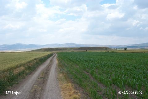 |
|
Type:
|
Mound |
|
Altitude:
|
805 m |
|
Region:
|
Central Anatolia |
|
Province:
|
Eskisehir |
|
District:
|
Merkez |
|
Village:
|
Karahüyük |
|
Investigation Method:
|
Survey |
|
Period:
|
|
|
|
|
 |
|
| It lies 1 km north-northwest of Karahüyük Village; about 35 km east of Eskisehir Province. Karahüyük-Bahçecik road passes 800 m southeast of the mound. It was discovered by Kiepert; and further investigated during a survey conducted in Bilecik and Eskisehir in 1994 by T. Efe. It is a big mound. It measures 14 m in height and 460 m in diameter. It is indicated that the site had been inhabited continuously from the beginning of EBA to the end of Roman Period. It takes place in the registered archaeological sites list prepared by Ministry of Culture and Tourism. |
| Location: |
| Geography and Environment: |
| History: |
| Research and Excavation: |
| Stratigraphy: |
| Small Finds: |
| Remains: |
| Interpretation and Dating: |