|
©The Archaeological Settlements of Turkey - TAY Project
|
|
|
|
|
|
Karahöyük / Erzin |
|
|
For site maps and drawings please click on the picture...  |
For photographs please click on the photo... 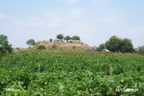 |
|
Type:
|
Mound |
|
Altitude:
|
60 m |
|
Region:
|
Mediterranean |
|
Province:
|
Hatay |
|
District:
|
Erzin |
|
Village:
|
Merkez |
|
Investigation Method:
|
Survey |
|
Period:
|
Late |
|
|
|
 |
|
| The mound with a flat top; measuring 15 m in height; lies 900 m south of Ceyhan-Iskenderun motorway; 8 km southwest of Erzin station on the railroad between Toprakkale and Iskenderun; southwest of Erzin District of Hatay Province. It was discovered by M.V. Seton Williams in 1951. There are modern settlements on and around the site. Architectural remains; dating to the Late Roman Period; sherds; dating to the EBA; MBA-LBA and Iron Age; were collected from the surface. Amuq F sherds in smoothed-surfaced; light slipped ware; belonging to the Late Chalcolithic Age; were found on the surface during the survey around the shore of Çukurova in 1991 conducted by the University of Bilkent. It takes place in the registered archaeological sites list prepared by Ministry of Culture and Tourism. |
| Location: |
| Geography and Environment: |
| History: |
| Research and Excavation: |
| Stratigraphy: |
| Small Finds: |
| Remains: |
| Interpretation and Dating: |