|
©The Archaeological Settlements of Turkey - TAY Project
|
|
|
|
|
|
Kara Elbistan |
|
|
For site maps and drawings please click on the picture...  |
For photographs please click on the photo... 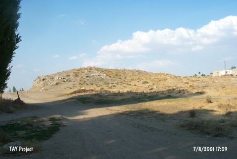 |
|
Type:
|
Mound |
|
Altitude:
|
1200 m |
|
Region:
|
Eastern Anatolia |
|
Province:
|
Kahramanmaras |
|
District:
|
Elbistan |
|
Village:
|
Karaelbistan |
|
Investigation Method:
|
Survey |
|
Period:
|
|
|
|
|
 |
|
| It lies north of Karaelbistan Village; about 5 km east of Elbistan District; north of Kahramanmaras Province. North of the mound flows Sögütlü Stream. It looks like a flat mound. It is 6 m high. It has been invaded by the graves of the modern village. Since vast majority of the sherds dates from the EBA; it is suggested that the main occupation was during that period. T. Özgüç excavated the site for a season in 1947. In 1962; the surface collection from an area of 70x100 m yielded black rimmed ware; Ozan Höyük ware; mottled washed ware; Cappadocian-like ware or imitation ware. Also; very restricted number of simple plain ware found at the Amuq Plain was recovered. It was researched again by E. Konyar et al. in 2007. The presence of Karaz and Transcaucasian sherds at the mound suggests connections with Euphrates encatchment area and East Anatolia [Konyar 2009:176]. Since 2013, Kahramanmaras Museum has been leading excavations at Kara Elbistan. |
| Location: |
| Geography and Environment: |
| History: |
| Research and Excavation: |
| Stratigraphy: |
| Small Finds: |
| Remains: |
| Interpretation and Dating: |