|
©The Archaeological Settlements of Turkey - TAY Project
|
|
|
|
|
|
Kanal Höyük |
|
|
For site maps and drawings please click on the picture...  |
For photographs please click on the photo... 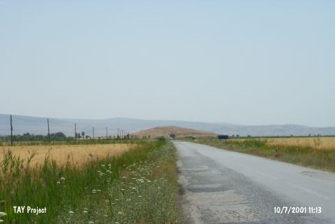 |
|
Type:
|
Mound |
|
Altitude:
|
1030 m |
|
Region:
|
Mediterranean |
|
Province:
|
Konya |
|
District:
|
Seydisehir |
|
Village:
|
Merkez |
|
Investigation Method:
|
Survey |
|
Period:
|
|
|
|
|
 |
|
| The mound; also known as Üzümlü Höyük; lies southwest of Konya; 7.9 km east of Seydisehir; west of Bagra village. It was discovered by J. Mellaart. |
| Location: This site lies southwest of the city of Konya; 7.5 km east of the town of Seydisehir and west of the village of Bagra. The mound; published as Kanal Höyük; is locally also called Üzümlü Höyük; Baglasi Höyük and Höyük Baglari. |
| Geography and Environment: The mound lies in the middle of the Seydisehir Plain; immediately west of the point where the Beysehir Canal Stream forks. East of the Beysehir underground stream; which lies along the tectonic depression between Beysehir and Sugla; is the volcanic Mount Alacadag and Mount Erenler while high hills formed by tectonic movements lie west of this stream. The Plain is covered by a thick layer of alluvial deposit. The Beysehir underground stream was formed by the flow of the excess water from Lake Beysehir to the 30 m lower Lake Sugla. Today the underground stream no longer empties into Lake Sugla and instead joins Çarsamba Stream via the Balikova Strait. |
| History: |
| Research and Excavation: |
| Stratigraphy: |
| Small Finds: |
| Remains: |
| Interpretation and Dating: |