|
©The Archaeological Settlements of Turkey - TAY Project
|
|
|
|
|
|
Alisar Höyük |
|
|
For site maps and drawings please click on the picture... 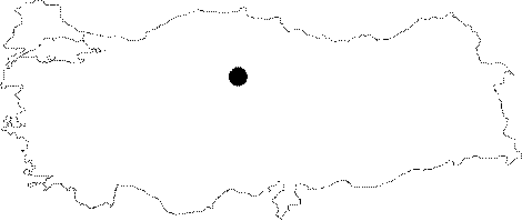 |
For photographs please click on the photo...  |
|
Type:
|
Mound |
|
Altitude:
|
1010 m |
|
Region:
|
Central Anatolia |
|
Province:
|
Yozgat |
|
District:
|
Sorgun |
|
Village:
|
Alisar |
|
Investigation Method:
|
Excavation |
|
Period:
|
EBA III EBA II |
|
|
|
 |
|
| Location: It lies about 2;5 km north of the Alisar Village; south of the Sorgun District; southeast of the Yozgat Province. |
| Geography and Environment: The mound is located on a big plain irrigated by the Konak Suyu. It is believed that the Konak Suyu used to flow near the mound. Alisar is the biggest settlement in Central Anatolia. The main settlement of Alisar is reported to measure ca. 520x350 m in dimensions in accordance with the distribution of sherds. A conic height rises in the middle of the terrace up to 30 m high measuring 245x145 m in dimensions. The mound was named after the nearest village; Alisar. |
| History: |
| Research and Excavation: The site was excavated for six seasons between 1927-36 by H.H. von der Osten of Oriental Sciences Institute; University of Chicago by the collaboration of E.F. Schmidt. The team became the centre of a heavy criticism following the lack of significant finds during the excavations. Although it was carefully and scientifically excavated compared to some other excavations carried out in the same period; the layers were mixed. Probably the displacement of the settlements; in addition to the size of the mound; played an important role in this result. It is a multi-cored mound. The first cultural deposit dating from the Late Chalcolithic Age/Early Bronze Age is followed by the third layer dated from the EBA III. The layer of the second millennium BC which was supposed to be enumerated later was named as layer II. The excavations were restarted from 1992. The recent excavations would; surely; bring the lower levels out to take their place in the Anatolian archaeology as well as bringing the settlement to a key position in the vicinity. It takes place in the registered archaeological sites list prepared by Ministry of Culture and Tourism. |
| Stratigraphy: As the excavated area is small and the trenches of the conic hills and the terrace could not be combined; the stratification was identified distinctively by the excavators. In recent years; many scientists accept the stratification for the prehistoric period provided herein below; [Huot 1982:72] [Yakar 1985a:198] [Orthmann 1963a:table 2]. Late Chalcolithic Age/Early Bronze Age I: Level 0; 19 M -15 M (top hill) EBA II-IIIa (Copper Age): level Ib; 11 M-7 M(hill)/14-12 T (terrace) EBA IIIb: levell III; 6 M (hill)/11 T (terrace) Intermediate period: level III; 5 M (hill)/10-9 T (terrace) Early Hittite Period: level II New Hittite Period: level IV Phygr-Med-Pers Periods: level V Hellenistic-Galat-Roman-Byzantian Periods: level VI Seljuk-Ottoman Periods: level VII |
| Small Finds: Architecture: No detailed information is available regarding the EBA I level among the EBA levels of the mound. It is very hard to distinguish the finds of this period from the finds of the Late Chalcolithic Age considering the cultural hierarchies. The EBA I layer of Alisar is equal with the building levels 14 - 12. The settlement was enlarged during this period compared to the Late Chalcolithic Age. Still a simple construction technique is observed. The EBA periods II-IIIa (Alisar level Ib) also known as the Copper Age are represented by the building levels 14 - 13 in the terrace trench. The 2 m thick city wall built on stone foundation encircles a big elliptical city. Big stones were used for the foundation. Mudbricks are in good order. This military architecture which was revealed in the terrace trench provides an evidence for a significant settlement at Alisar. The same period was found at the building levels 11 and 7 of the top hill trenches. On the other hand; only common houses owned by people were uncovered here. The buildings look like positioned along a passage. Just like the walls; mudbricks were employed as a construction material. The buildings consist of quadrangular rooms with floors of compressed soil. Their corners have angular edges. Some walls are plastered. The last period of the EBA IIIb and the intermediate period (transition from EBA to MBA) are represented by the building levels 6 - 5 on the top hill; and the building level 12 on the terrace. Those building levels are shown as layer III in the stratification of Alisar. Houses have been attested with scanty remains. The city has grown bigger in the terrace compared to the preceding period. There is a city wall of 1;5 m thick in the building level 6. Big stones were used for the foundation. The mudbrick superstructure of the wall is supported by wooden beams. The beams were placed in the sense of a grill to reinforce the wall. The city is suggested to have served as a significant principality centre. In the building level 5 M yielding the transition to the second millennium BC; the city got even bigger. Although the uncovered part of the wall reaches a thickness of 4 - 5 m; other parts are presumed to be thinner because this thickness is valid only where there is a gate piercing the walls. Very roughly treated quarry stones were used for the outer and inner surfaces of the wall. They were filled in with smaller stones. The city wall is pierced by a gate flanked with two towers on both sides. It is interesting to find the South Gate; the gate to the city; at the same location only bigger in size. Ceramics: The pottery industries of the levels 0 and Ia of Alisar are almost identical (see. Harmankaya et al. 1998:Alisar Höyük). On the level Ib dating from the EBA II and III; the handmade; red washed burnished ware is dominant [Schmidt 1932: 41]. Handled cups; side spouted jars and vessels produce of this ware seem very popular [Orthmann 1963:pl.9-10]. Also found are painting decorated samples. The decorations were applied by reddish brown paint on yellowish brown wash; by red paint on yellowish beige; and by white paint on red background [Orthmann 1963: pl.11]. On the last building level; depas and depas-like cups/beakers are introduced. They also bear painting decorations. They are not very rich in variety. Some are decorated with thick bands. The number of incision decorated vessels are very poor. The level EBA IIIb revealed aside handmade; wheel-made pottery. The red washed burnished ware continues. Painted ware is recovered as well. The Capadoccian ware also known as Alisar III pottery is decorated with dark brown or dark reddish brown paint on a buff washed background. Some of the samples have a white base on where the decoration is applied. They are easily distinguished by their authentic geometrical figures unlike other pottery industries of Central Anatolia. Big handled cups; bowls; four handled ovoid bowls vessels are made of this ware. The building level 5 M; bearing the characteristics of the intermediate period; revealed painted vessels and sherds of so called "transition ware". Although this group of ware resembles the Cappadoccian ware; it is richer in the variety of decorations. The Cappadoccian ware continues. Clay: Especially figurines and goddess statues are of terra cotta. There are several types of idols. Besides the disc-headed idols; there are schematized idols with arms as well [Schmidt 1932:fig.62]. In the building level 6 M; fragments of movable hearths which are called altar with horns were revealed. Such fragments were recovered from almost all building levels. Some are decorated. The loomweights prove that the society of this period knew how to weave. Chipped Stone: The industry is not distinctive in any of the EBA levels. Although obsidian and flintstone were the main raw material; obsidian was in use more often. Furthermore; there are tools made of chalcedony. In general; blade industry dominates. The industries of EBA do not differ one from another depending on the regions. Ground Stone: This industry includes objects only used as tools; besides the ones used both as weapons and tools such as shaft-holed axes. Vast majority of them are axe/hammers. The flat axes were made of every kind of stones. There are maces made of serpentine and marble. Polishing stones were probably utilized when burnishing the vessels. Schematized figurines of sheep and goat were carved into hard stones like serpentine suitable for polishing. The stone seals are not distinctive than their clay samples. They have basic geometrical figures on their stamping faces. They are decorated with usual patterns of Central Anatolia. Metal: Copper/bronze objects like awls; knives; circular pins used during the daily life or as ornaments were recovered from the building levels 14 - 7. The fact that they were familiar with the production of lead proves their familiarity with silver. Almost all types of pins identified in Anatolia during the first half of the third millennium BC were recovered. The dagger with three rivets and a triangular tang found at layer III is one the beautiful samples of its age [Schmidt 1932:fig.270]. Human Remains and Graves: The burial practices of the mound starts from the building levels of the Late Chalcolithic Age with intramural cemetery and continues onto the levels Ia and Ib in the same sense. Of 46 graves; most were uncovered under the floors. Other than simple pit burials; there are cist and pithos graves. The cist graves were built by flat stone plates. However; some were built with mudbrick. The dead were buried in hocker position accompanied with restricted number of grave goods. These goods include copper spirals; and objects like terra cotta spindle-whorls. The cemetery is still intramural during the end of EBA. However probably by coincidence; very few graves were found. Vast majority of them is the simple pit burials. The grave goods are very poor in number. |
| Remains: |
| Interpretation and Dating: The Early Bronze Age levels of Alisar reveal the relationships between Southeastern Anatolia; Northern Anatolia and Central Anatolia. As the first excavation was ended shortly; this relation was not clarified in detail. Wheat was the most consumed grain in that mixed economy of agriculture and animal husbandry. Besides cattle; sheeps; goats; pigs and dogs were breaded. It is suggested that during the third millennium BC; the city was a principality centre surrounded with a strong fortification wall. The city of the transition period at the end of the third millennium BC should have been the most significant city of the region. The city of Kussar which was conquered in the nineteenth century BC by the Hittite King; Anitta; who was one of the founders of the Hittite Empire; is most likely Alisar itself. The massive fire in the building level 6 on the top hill may be related to that conquest. If this was the case; its name should have been Kussar; or something similar during the third millennium BC Although the dating of the stratifications is not complete yet; suggested dates are 2500 - 2300 BC for the layer Ib; and 2300 - 2000 for the layer III. |