|
©The Archaeological Settlements of Turkey - TAY Project
|
|
|
|
|
|
Kaddahiyyat Ali Bey |
|
|
For site maps and drawings please click on the picture... 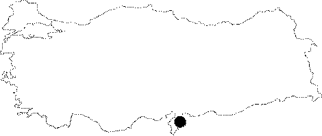 |
For photographs please click on the photo... 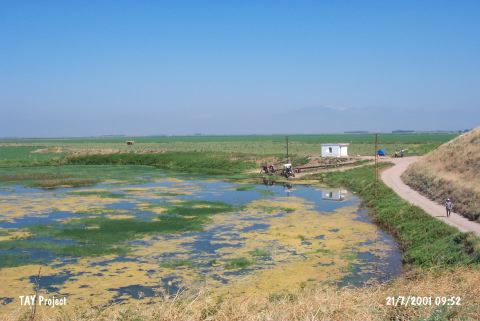 |
|
Type:
|
Mound |
|
Altitude:
|
150 m |
|
Region:
|
Mediterranean |
|
Province:
|
Hatay |
|
District:
|
Reyhanli |
|
Village:
|
Karatas |
|
Investigation Method:
|
Survey |
|
Period:
|
Ceramic |
|
|
|
 |
|
| Location: This site lies northeast of the city of Antakya; 8 km north of Harim. |
| Geography and Environment: This small; low-lying mound lies in the Amuq Plain north of Kizil Irk Stream; which springs from the Reyhanli Region and flows west. The inhabitants of the mound may have used Kizil Irk Stream as their main water source. The soil surrounding the mound in the Amuq Plain in general is very fertile. This plain; also called the Hatay Plain; lies in the low area between Maras and Antakya. Lake Antioch; which is fed by the Karasu and Afrin Streams; lies in the lowest part of the plain. The lake has shrunk immensely in size. The Amuq Plain is bounded by the Amanos Mountains to the west; the Kuseyr Plateau to the south and Mount Kurt to the northeast. |
| History: |
| Research and Excavation: The mound was first discovered in 1936 by the surface survey conducted by the University of Chicago; Oriental Institute [Braidwood 1937:32]. |
| Stratigraphy: Analysis of the ceramics collected from the surface of the mound have been assigned to the Neolithic and Medieval Periods. |
| Small Finds: Pottery: The mound yielded ceramics that resemble those found in Layer XIV of Tell el Cüdeyde/Judaidah. Detailed information has not been provided. (For more information on this Neolithic Ware see Tell el Cüdeyde/Judaidah; this volume). |
| Remains: |
| Interpretation and Dating: The site; which been assigned to the Amuq A and B cultural phases; should be re-researched. In ASPRO; the site referred to as Quaddahiyat has been placed in phase 5/6 and is dated to 8;000-7;000 BP [Hours et al. 994:227]. |