|
©The Archaeological Settlements of Turkey - TAY Project
|
|
|
|
|
|
Isgalaman Çingen Höyük |
|
|
For site maps and drawings please click on the picture...  |
For photographs please click on the photo... 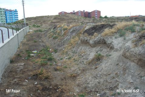 |
|
Type:
|
Mound |
|
Altitude:
|
1070 m |
|
Region:
|
Central Anatolia |
|
Province:
|
Konya |
|
District:
|
Karatay |
|
Village:
|
Merkez |
|
Investigation Method:
|
Survey |
|
Period:
|
|
|
|
|
  |
|
| It is located in the garden of the Tekel depot in the Isgalaman Quarter of Karatay District; southeast of Konya Province. It is a big and flat mound. It measure 20 m in height and 300x500 m in dimensions. It was discovered in 1997 by H. Bahar. Pottery of the Late Chalcolithic Age; the EBA; the second millennium BC and Classical Age (?) was recovered during the surface collection. Large part of the mound has been demolished due to terracing. It takes place in the registered archaeological sites list prepared by Ministry of Culture and Tourism. It was visited during the survey carried out by H. Bahar and his team in 2012. Bahar stated that the mound measures 300x300 m and its height ranges from 10 m to 5 m. During this survey, potsherds dated to EBA, Assyrian Trade Colonies Period and Roman-Byzantine periods were found [Bahar 2014:256]. |
| Location: |
| Geography and Environment: |
| History: |
| Research and Excavation: |
| Stratigraphy: |
| Small Finds: |
| Remains: |
| Interpretation and Dating: |

