|
©The Archaeological Settlements of Turkey - TAY Project
|
|
|
|
|
|
Iney / Inay |
|
|
For site maps and drawings please click on the picture...  |
For photographs please click on the photo... 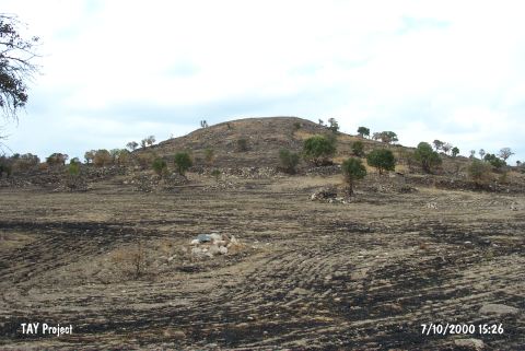 |
|
Type:
|
Mound |
|
Altitude:
|
730 m |
|
Region:
|
Aegean |
|
Province:
|
Usak |
|
District:
|
Ulubey |
|
Village:
|
Inay |
|
Investigation Method:
|
Survey |
|
Period:
|
EBA II |
|
|
|
 |
|
| It lies in the area known as Balçikli Mevkii; 7 km from Inay Village; 33 km south-southwest of Usak Province. It is a high and conical hill. On its southwestern section are stone shelters and on the top are remains of stone walls that probably belong to sheepfolds. It was introduced as a Beycesultan EBA II settlement. No further information is provided. |
| Location: |
| Geography and Environment: |
| History: |
| Research and Excavation: |
| Stratigraphy: |
| Small Finds: |
| Remains: |
| Interpretation and Dating: |