|
©The Archaeological Settlements of Turkey - TAY Project
|
|
|
|
|
|
Inandik |
|
|
For site maps and drawings please click on the picture...  |
For photographs please click on the photo... 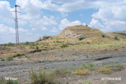 |
|
Type:
|
Mound |
|
Altitude:
|
705 m |
|
Region:
|
Central Anatolia |
|
Province:
|
Çankiri |
|
District:
|
Merkez |
|
Village:
|
Inandik |
|
Investigation Method:
|
Excavation |
|
Period:
|
|
|
|
|
 |
|
| The mound is located 1 km southeast of Hacibey bridge; 6 km southwest of Inandik Village; south of Çankiri. Northwest of the mound Terme Stream runs and east-southeast of it Ankara-Zonguldak railroad passes. The northeast part of the mound was excavated by H. Alkim. |
| Location: |
| Geography and Environment: |
| History: |
| Research and Excavation: |
| Stratigraphy: |
| Small Finds: |
| Remains: |
| Interpretation and Dating: |