|
©The Archaeological Settlements of Turkey - TAY Project
|
|
|
|
|
|
Ikiz Höyük |
|
|
For site maps and drawings please click on the picture... 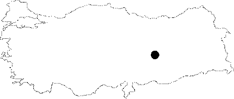 |
For photographs please click on the photo...  |
|
Type:
|
Mound |
|
Altitude:
|
685 m |
|
Region:
|
Eastern Anatolia |
|
Province:
|
Malatya |
|
District:
|
Battalgazi |
|
Village:
|
Kulusagi |
|
Investigation Method:
|
Excavation |
|
Period:
|
Middle |
|
|
|
 |
|
| Location: The site lies 25 km northeast of Malatya; east-northeast of Battalgazi District; approximately 500 m northwest of Kulusagi Village; at the western side of the road leading to Meydancik Village; which is inundated today. |
| Geography and Environment: The mound is under water at times when the water level of Karakaya Dam increases; and emerges at other times forming a cape. Auscillation of the water level effects the mound. Therefore; it may be totally destroyed in the present. The finds of the settlement were on the terraces; formed by the river; in 1989. Dimensions are not exactly known. The cultural deposit of the mound is observed to be 1.5 m thick. The mound consists of two elevations; one at the south and the other at the north; separated by a defile. For this reason; it was named as "Ikiz Höyük" by Degirmentepe team. The mound is on top of a conglomerate; natural elevation. |
| History: |
| Research and Excavation: The site was discovered by the team of Malatya Degirmentepe Excavation in 1987; and was excavated in 1989; for 9 days; by U. Esin to obtain information before it was totally destroyed. |
| Stratigraphy: The stratigraphy of the mound was only found out at the northern elevation. Of the 4 levels found; the remains at the 1st Level suggest a small village; dating to the Ottoman Period. 2nd and 3rd Levels belong to the Ubaid Period of Chalcolithic Age; and the 4th Level dates to the LNA-Early Chalcolithic Age (For the last level finds see. Harmankaya et al. 1997:Ikiz Höyük). Virgin soil was reached. Although a little amount of Karaz ware; dating to the EBA; on the surface suggest a small EBA settlement; there were not so many traces revealed; belonging to this settlement. |
| Small Finds: Architecture: Pits dug into the arid earth; 50 cm deep from the surface; and negative traces of pillars thought to belongto the wattle and daub huts hint the existence of a seasonal settlement in the Chalcolithic Age. Revelation of mud-brick pieces in some pits suggest that a probable mud-brick structure might be damaged by the Ottoman Period structures above. Pottery: Ubaid Period sherds are observed to be more in number on the surface than at the 2nd and the 3rd Levels. Ubaid Period sherds; reddish brown paint decorated over light colored surface; were recovered besides the plain wares. This ware resembles Degirmentepe (Malatya) finds; which is very close to Ikiz Höyük. Chipped Stone: Abundant star-shaped chipped stone finds made of flintstone and quartz were recovered from the terraces formed by erosion. They are thought to be functioning as perforators and scrapers. Very similar tools were found in Degirmentepe. Ground Stone: Burnished flat axes; and many flat tools made of a type of sandstone were recovered from the surface. Grinding stones suggest agricultural activities. |
| Remains: |
| Interpretation and Dating: 14C dates of Ikiz Höyük could not be determined. Therefore; the position of the site in the cultural history is dependent on the resemblances with the finds of Degirmentepe excavations. The relations between Degirmentepe and Ikiz Höyük could not be well explained because of the short excavation time and because of excavating a small area. Ikiz Höyük is thought to be a seasonal settlement for now. The finds recovered from the mound suggest that Ubaid Culture had spread out to a broader area than was known previous to the recent field-work in the region. There must be many such Ubaid Period settlements along the natural trade routes like Euphrates. |