|
©The Archaeological Settlements of Turkey - TAY Project
|
|
|
|
|
|
Bogazköy |
|
|
For site maps and drawings please click on the picture... 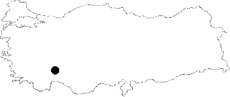 |
For photographs please click on the photo...  |
|
Type:
|
Single Findspot |
|
Altitude:
|
820 m |
|
Region:
|
Mediterranean |
|
Province:
|
Burdur |
|
District:
|
Bucak |
|
Village:
|
Bogazköy |
|
Investigation Method:
|
Survey |
|
Period:
|
|
|
|
|
 |
|
| This site is south of the city of Burdur; approximately 6.5-7 km northwest of the village of Bademagaci in the Bucak Township; east-southeast of the village of Bogazköy. The site is by the Burdur-Antalya highway; near the village of Bogazköy at the southern border of Burdur Province. There are water sources in the region. The acropolis of the ancient city of Panemoteichos lies on a hill with an altitude of 1;000 m. The city; dating to the 7-6 centuries BC; is surrounded by well-built 3.6 km thick stone walls with towers. The finds from this ancient city are badly damaged. There is a statue pedestal, discovered by S. Mitchell, at the right front corner of the garden wall of the mosque in the village. To the east of the village is a cistern built with large blocks in the polygonal technique. Inside the cistern, there is a plastered wall erected with small stones. The cistern consists of two rooms that are connected to each other with arched doors. There are more than twenty khamosorion tombs in the rocky area in the northwest of the cistern. One of them is an arcosolium tomb that was carved into a natural recess. There are water slots on the southern slope of the valley, in the east of the city. These water slots connect to the square-formed stilling polls [Metin 2017:314]. |
| Location: |
| Geography and Environment: |
| History: |
| Research and Excavation: |
| Stratigraphy: |
| Small Finds: |
| Remains: |
| Interpretation and Dating: |