|
©The Archaeological Settlements of Turkey - TAY Project
|
|
|
|
|
|
Ikinciler / Kazan Höyük |
|
|
For site maps and drawings please click on the picture...  |
For photographs please click on the photo... 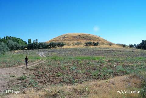 |
|
Type:
|
Mound |
|
Altitude:
|
1040 m |
|
Region:
|
Eastern Anatolia |
|
Province:
|
Malatya |
|
District:
|
Akçadag |
|
Village:
|
Ikinciler |
|
Investigation Method:
|
Survey |
|
Period:
|
Late |
|
|
|
 |
|
| It lies east of Dogansehir road; 6.5 km south of Akçadag; west-southwest of Malatya. The round mound; measuring 75 m in diameter is located south of Ören Village. It was discovered by C.A. Burney in 1965. EBA ceramics were collected. According to Russel; sherds of chaff-faced burnished ware; and a little amount of dark faced burnished ware dating back to the Chalcolithic Age are existent. It takes place in the registered archaeological sites list prepared by Ministry of Culture and Tourism. |
| Location: |
| Geography and Environment: |
| History: |
| Research and Excavation: |
| Stratigraphy: |
| Small Finds: |
| Remains: |
| Interpretation and Dating: |