|
©The Archaeological Settlements of Turkey - TAY Project
|
|
|
|
|
|
Isildak Tepe |
|
|
For site maps and drawings please click on the picture...  |
For photographs please click on the photo... 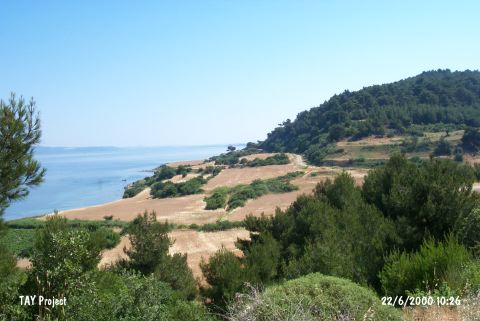 |
|
Type:
|
Mound |
|
Altitude:
|
60 m |
|
Region:
|
Marmara |
|
Province:
|
Çanakkale |
|
District:
|
Merkez |
|
Village:
|
Intepe |
|
Investigation Method:
|
Survey |
|
Period:
|
EBA II |
|
|
|
 |
|
| It lies on the southern part of the Dardanelles; 5 km west of Intepe (Erenköy); about 25 km southwest of Çanakkale Province. It stands on an outcrop extending to the sea. It is located in the end of a valley called Çiftlik. It is 50 m high above the sea level. There lies a coastal line of agricultural area in front. It was discovered by A. Akarca in 1976 during the surveys conducted in the region. Troy I style bowls burnished in gray or buff with inrolled rim and a fragment of a rim belonging to a vertical and three footed vessel of black and coarse paste were recovered. The settlement is dated to the EBA II. Also recovered is pottery of Troy IV as well as a restricted number of the Classical Period pottery. |
| Location: |
| Geography and Environment: |
| History: |
| Research and Excavation: |
| Stratigraphy: |
| Small Finds: |
| Remains: |
| Interpretation and Dating: |