|
©The Archaeological Settlements of Turkey - TAY Project
|
|
|
|
|
|
Dörtagaç |
|
|
For site maps and drawings please click on the picture...  |
For photographs please click on the photo... 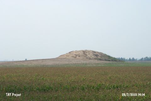 |
|
Type:
|
Mound |
|
Altitude:
|
70 m |
|
Region:
|
Mediterranean |
|
Province:
|
Adana |
|
District:
|
Seyhan |
|
Village:
|
Dörtagaç |
|
Investigation Method:
|
Survey |
|
Period:
|
|
|
|
|
 |
|
| It lies on the western bank of the Seyhan River; northeast of Dörtagaç Village; southeast of Yolacan Village; 15 km southwest of Adana Province. The surrounding territory is used to be a swamp but it is dried now and being cultivated. There is no village around. It has a high conic top hill and terraces. A farm building lies adjacent to it. It was discovered during the Cilicia survey in 1951. Vast majority of the pottery collected is EBA ware of Tarsus Gözlükule. Also found is pottery of the Hittite Period. |
| Location: |
| Geography and Environment: |
| History: |
| Research and Excavation: |
| Stratigraphy: |
| Small Finds: |
| Remains: |
| Interpretation and Dating: |