|
©The Archaeological Settlements of Turkey - TAY Project
|
|
|
|
|
|
Horum Höyük |
|
|
For site maps and drawings please click on the picture... 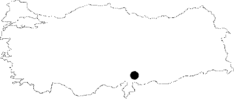 |
For photographs please click on the photo...  |
|
Type:
|
Mound |
|
Altitude:
|
350 m |
|
Region:
|
Southeastern Anatolia |
|
Province:
|
Gaziantep |
|
District:
|
Nizip |
|
Village:
|
Toydemir |
|
Investigation Method:
|
Excavation |
|
Period:
|
EBA III EBA I EBA II |
|
|
|
 |
|
| Location: The site lies approximately 15 km north of Nizip District of Gaziantep; 25 km away from Birecik; 1.8 km east of Toydemir (Acemi) Village; at the western bank of Euphrates. |
| Geography and Environment: The mound; located near Euphrates; was discovered during the surface surveys conducted by G. Algaze. It covers an area of 21 hectares. However; according to the topographical observations in 1996; it covers an area of 6.4 hectares. |
| History: |
| Research and Excavation: It was discovered during the 1989 survey conducted by the University of Chicago under G. Algaze in order to find out the settlements and remains that would have been submerged by the Birecik and Kargamis dams [Algaze et al. 1994:30-31]. Based on the pottery collected during the survey conducted on the top hill and the lower city; it is suggested that the site had been inhabited from the Obeid Period until the Islamic Period. When it was seen that the site will be flooded; a salvage excavation of four years was planned before the start of the dam. It was excavated from 1996 by the Museum of Gaziantep under the guidance of A. Tibet and C. Marro of the French Archaeological Institute. Excavations ended in 1999. It takes place in the registered archaeological sites list prepared by Ministry of Culture and Tourism. |
| Stratigraphy: On the basis of the excavation and survey finds; it is suggested that the site had been occupied during the fifth-fourth millennia BC; the third millennium BC; the beginning of the second millennium BC; the Early Iron Age; the Hellenistic-Roman and Islamic Periods. The publications covering only the first four years' outcomes do not provide any precise information about the stratification. However; the deposit of the third millennium BC. is reported to be thick. |
| Small Finds: Architecture (descending order): The settlements of EBA IV and III (according to the Syrian-Levant chronology) were observed to be destroyed by the Middle Age settlement in some parts. The trench F yielded only two rooms of the building no. F0129 of EBA IV. It was built of mudbrick on a stone socle. The walls are ca. 1 m thick. The corners of the stone structure are quadrangular while they are rounded in the mudbrick superstructure. Only a portion of 1 m high survived to present day. Between the rooms; there are doorposts in stone. The northern and southern rooms of this building which underwent a fire are paved with stone. The northern room has a hole for pillar in limestone. Below this building lies a structure (F0130) having the same characteristics of the previous phase. The finds of both phases are contemporary with Kurban III. The trench B yielded a kitchen; partly excavated; built on stone foundations in two lines belonging to EBA IV [Tibet et al.1999:draw.8; Marro et al 1998b:pl.VIII]. A double hearth in horseshoe style was found in this kitchen. It was built of clayed earth and plastered. It has two adjacent hearths; one smaller than the other [Marro et al.1998b:photo 4-5]. Trench B yielded almost collapsed architectural remains of EBA II. It is contemporary with Kurban IV. The finds of this phase were recovered under the kitchen. The EBA I layer is reported to measure very thick. The presence of structures built by mudbrick wall on a stone socle much same as the construction technique at the other EBA settlements of Bilecik region is observed [Tibet et al. 2000:draw.2]. The excavators report that this technique was maintained throughout the all phases of EBA. Pottery: The excavators report that the likes of pottery with chess-board pattern or straight burnished and decorated vessels; jars with out-turning lips and narrow necks of washed and unwashed ware recovered from the EBA IV and III are found at Kurban Höyük III; Hammam et Turkman VI; Tell Hadidi; Til Barsib; Tell Qra Quzag III; Tell Banat and Tell Siyuh Faugani. The most common form is the small cups called Hama Cups. They were also recovered from Kurban Höyük III; Gedikli and Tilmenhöyük. EBA II yielded three footed cups and incision decorated cylindrical vessel with pedestal. Likes of them are found at Kurban Höyük IV. EBA I yielded diagonal and vertical samples of the reserved slip decorated ware; the band lipped and incision decorated ware [Tibet et al. 2001:139; draw.8-9]. Sherds of the Nineveh V ware and the simple plain ware (fine ware) contribute to the dating of this layer to 2900 BC. Metal: EBA IV yielded a small spearhead [Marro et al. 2000:draw 7/10]. Human Remains: Two graves; one cist grave and the other being a pithos grave; were found under the floor of the kitchen belonging to EBA IV at trench B. The cist grave belongs to a 5-9 years old child. The grave goods consist of three miniature cups and a circular bronze pin. The pithos housing an infant burial and an embryo is surrounded by 12 miniature cups as grave goods. Both graves were dated to EBA IV by the excavator. Intramural infant and children burials are also seen at EBA I. The cemetery of adult burials should be explored in the vicinity. |
| Remains: |
| Interpretation and Dating: The most significant outcome of the excavation is that the site had been heavily inhabited at the beginning and end of the third millennium BC. The EBA III and IV of Horum Höyügü are dated to 2250/2300-2000 BC. The settlement of EBA IV is significant. The suggested dates for EBA II are 2800-2300 BC and for EBA I; 3000-2800 BC. Even tough it was not a significant settlement during EBA; the ruins of the castle and the size of the lower city expose that it housed a big settlement in late periods. It was excavated in 2000 and unfortunately it was flooded like many other settlements lying beneath the reservoir waters of the Keban; Karakaya and Atatürk dams. |