|
©The Archaeological Settlements of Turkey - TAY Project
|
|
|
|
|
|
Horum Höyük |
|
|
For site maps and drawings please click on the picture... 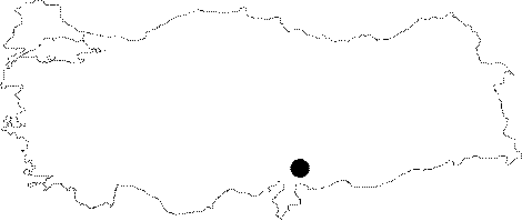 |
For photographs please click on the photo...  |
|
Type:
|
Mound |
|
Altitude:
|
350 m |
|
Region:
|
Southeastern Anatolia |
|
Province:
|
Gaziantep |
|
District:
|
Nizip |
|
Village:
|
Toydemir |
|
Investigation Method:
|
Excavation |
|
Period:
|
Late Middle |
|
|
|
 |
|
| Location: The site lies approximately 15 km north of Nizip District of Gaziantep; 25 km away from Birecik; 1.8 km east of Toydemir (Acemi) Village; at the western bank of Euphrates. |
| Geography and Environment: The mound; located near Euphrates; was discovered during the surface surveys conducted by G. Algaze. It covers an area of 21 hectares. However; according to the topographical observations in 1996; it covers an area of 6.4 hectares. |
| History: |
| Research and Excavation: It was discovered during the 1989 survey conducted by the University of Chicago under G. Algaze in order to find out the settlements and remains that would have been submerged by the Birecik and Kargamis dams [Algaze et al. 1994:30-31]. Based on the pottery collected during the survey conducted on the top hill and the lower city; it is suggested that the site had been inhabited from the Obeid Period until the Islamic Period. When it was seen that the site will be flooded; a salvage excavation of four years was planned before the start of the dam. It was excavated from 1996 by the Museum of Gaziantep under the guidance of A. Tibet and C. Marro of the French Archaeological Institute. Excavations ended in 1999. It takes place in the registered archaeological sites list prepared by Ministry of Culture and Tourism. |
| Stratigraphy: Ubaid and Uruk sherds were recovered besides the EBA; EBA 3 / MBA 1; Hellenistic; Roman; and Islamic Period sherds during the surface collections of Algaze. According to the first results of the first excavation at the site in 1996; the latest period at Horum Höyük is the Medieval Age; dating to the 12-14th Centuries. Below this is the MBA and LBA; and finally Middle Chalcolithic and Late Chalcolithic Ages are at the lowest level [Marro et al. 1997:375]. |
| Small Finds: The Chalcolithic pottery collected during the surface collections consists of the typical Coba bowls and painted vessels of Ubaid culture; and beveled rim bowls of Uruk culture. Halafian; Ubaid; and Late Uruk sherds were recovered from the same deposit (Trench D) during the 1996 excavations. However; their relations and stratigraphical problems could not be understood yet. Obsidian pieces were also found. According to the first observations; the mixed Middle and Late Chalcolithic Age sherds that may date to Amuq Phase D-F; and flintstone tools were recovered from a big pit that cuts this deposit; the analyses still continue. Painted sherds resemble the Ubaid painted vessels; and similar to the Amuq Phase D and E pottery in form and decoration. Colors; varying from beige to black; are observed on plain wares. Most of them are plant-tempered. They may be compared to Amuq Phase E and F in form [Marro et al. 1997:375]. |
| Remains: |
| Interpretation and Dating: |