|
©The Archaeological Settlements of Turkey - TAY Project
|
|
|
|
|
|
Hinsor |
|
|
For site maps and drawings please click on the picture...  |
For photographs please click on the photo... 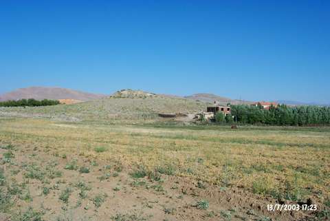 |
|
Type:
|
Mound |
|
Altitude:
|
1085 m |
|
Region:
|
Eastern Anatolia |
|
Province:
|
Elazig |
|
District:
|
Merkez |
|
Village:
|
Örençay |
|
Investigation Method:
|
Survey |
|
Period:
|
Early Middle |
|
|
|
 |
|
| The 5 m high mound; measuring 50 m in diameter; lies 700 m east of Örençay Village; southwest of Elazig. The dirt road that joins Elazig-Baskil motorway passes north of the mound. A surface collection was made by C.A. Burney in 1956. One plain pinkish buff ware sherd; which is greenish slipped on the exterior and matte black-brown paint decorated; probably belongs to the Hassuna Period [Burney 1958:fig.2]; and another sherd; in the same ware; which is red matte paint decorated on the interior; belongs to the Halaf Period. In addition; sherds of buff-ware; red ware; pale greenish ware (probably Ubaid Period); dating to the Chalcolithic Age; were collected from the surface. The mound; considering the resemblances with Yumuktepe XXIII-XX; is dated to the 7th phase in ASPRO. It takes place in the registered archaeological sites list prepared by Ministry of Culture and Tourism. |
| Location: |
| Geography and Environment: |
| History: |
| Research and Excavation: |
| Stratigraphy: |
| Small Finds: |
| Remains: |
| Interpretation and Dating: |