|
©The Archaeological Settlements of Turkey - TAY Project
|
|
|
|
|
|
Hayaz Höyük |
|
|
For site maps and drawings please click on the picture... 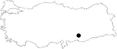 |
For photographs please click on the photo...  |
|
Type:
|
Mound |
|
Altitude:
|
380 m |
|
Region:
|
Southeastern Anatolia |
|
Province:
|
Adiyaman |
|
District:
|
Samsat |
|
Village:
|
Hayaz |
|
Investigation Method:
|
Excavation |
|
Period:
|
Late |
|
|
|
 |
|
| Location: This site lay south of the city of Adiyaman; 17 km west of the town of Samsat; and beneath the village of Hayaz; which has since been flooded by the Atatürk Dam Lake. It was very difficult to reach this village before it was flooded by the dam lake. The road from Samsat used to end at Kalburcu Stream. |
| Geography and Environment: Before the Atatürk Dam Lake was formed; this mound-site lay at the confluence of the Euphrates and Kalburcu Stream. The mound was on the flanks of a natural hill known as Herik Tepe along the Euphrates. The village of Hayaz was located on the western and southern fringes of the mound. The modern inhabitants of this village resorted to the mound for stone and soil and partially destroyed it. It is 9 m high and has a base diameter of 90 m. Since there are no springs in the nearby vicinity; the inhabitants of this site must have used both Kalburcu Stream and the Euphrates as their water supply. |
| History: |
| Research and Excavation: The site was discovered in 1975 during the Lower Euphrates Survey conducted in the region expected to be flooded by the Karakaya and Atatürk Dams by a team under the direction of Ü. Serdaroglu [Serdaroglu 1977:177; fig.43;47]. M. Özdogan of the Department of Prehistoric Archaeology of the University of Istanbul conducted a survey on the mound in 1977 [Özdogan 1977:144]. Many Neolithic chipped stone tools were found in the sections exposed in the areas damaged by the villagers. Excavations at the mound were conducted under the direction of J. Roodenberg of the Istanbul Dutch Institute of Archaeology; for four seasons between 1979-1983; excluding 1982. Since the village was not easily accessible and there was a modern settlement above the mound; the excavation was continued with difficulty until 1983. The mound is famous for its Aceramic Neolithi Age finds. |
| Stratigraphy: Excavations in 1980; 1981; and 1983 conducted for Lower Euphrates Basin Survey Project caused the revelation of different levels according to the surface finds. A very limited area could be excavated; because the site is beneath the modern settlement. 4 main levels were found in the excavations. The uppermost level mostly consists of Byzantine Period remains. Level 2; like the first level; consists of different period remains. Level 3 dates to the EBA 1 or EBA 2 according to the excavator; while Level 4 belongs to the Aceramic Neolithic. In addition; Chalcolithic and MBA sherds are existent among the surface finds. |
| Small Finds: Pottery: Sherds that may belong to the Chalcolithic Age; were recovered by Thissen [Thissen 1984:81-130]. Sherds of chaff-faced ware; flint-scraped ware are existent according to him. Chaff-faced ware is characteristic for Amuq Phase F. Sherds of this ware were recovered at the settlements around Keban and Karakaya Dams. The flint-scraped ware; known as Coba bowls; were recovered in the Late Chalcolithic Age levels of Norsuntepe and Korucutepe in Keban Region besides Sakçagözü Plain. Plate and bowls are abundant [Thissen 1985:fig.1-2]. |
| Remains: |
| Interpretation and Dating: Hayaz Höyük was extremely damaged because of the village above it. 1st and 2nd Levels are especially seriously damaged. Therefore; the Late Chalcolithic Age finds could not be revealed stratigraphically. |