|
©The Archaeological Settlements of Turkey - TAY Project
|
|
|
|
|
|
Hasattepe |
|
|
For site maps and drawings please click on the picture...  |
For photographs please click on the photo... 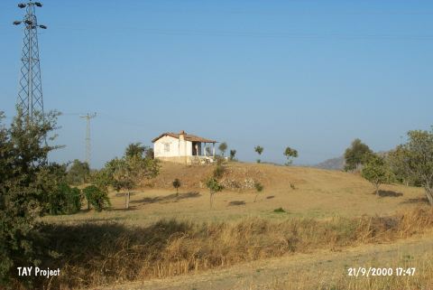 |
|
Type:
|
Mound |
|
Altitude:
|
50 m |
|
Region:
|
Aegean |
|
Province:
|
Aydin |
|
District:
|
Germencik |
|
Village:
|
Kizilcapinar |
|
Investigation Method:
|
Survey |
|
Period:
|
|
|
|
|
 |
|
| It lies about 1 km east of Kizilcapinar; 20 km north of the Aydin-Izmir highway; east of Aydin Province. It is a middle sized and round mound. It gets flattened towards the north. During the survey conducted by E. Akdeniz in 1995; pottery belonging to the EBA; the Early Iron Age and the Byzantine Period was collected from the surface. There is only one house on the arable hill which has been destroyed by illicit digging. It takes place in the registered archaeological sites list prepared by Ministry of Culture and Tourism. |
| Location: |
| Geography and Environment: |
| History: |
| Research and Excavation: |
| Stratigraphy: |
| Small Finds: |
| Remains: |
| Interpretation and Dating: |