|
©The Archaeological Settlements of Turkey - TAY Project
|
|
|
|
|
|
Hasköy Hamandere |
|
|
For site maps and drawings please click on the picture...  |
For photographs please click on the photo... 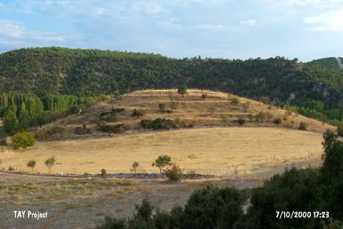 |
|
Type:
|
Mound |
|
Altitude:
|
640 m |
|
Region:
|
Aegean |
|
Province:
|
Usak |
|
District:
|
Ulubey |
|
Village:
|
Hasköy |
|
Investigation Method:
|
Survey |
|
Period:
|
EBA II |
|
|
|
 |
|
| It is west of Hamamderesi Stream; northern bank of the Banaz Stream; about 6 km south of Ulubey District; south of Usak Province. No village named Hasköy is mentioned in the 1:200.000 map. Emekse could be the former name of Hasköy. Another survey is necessary. According to D.H. French; it is an EBA II settlement. |
| Location: |
| Geography and Environment: |
| History: |
| Research and Excavation: |
| Stratigraphy: |
| Small Finds: |
| Remains: |
| Interpretation and Dating: |