|
©The Archaeological Settlements of Turkey - TAY Project
|
|
|
|
|
|
Hasirci 1 |
|
|
For site maps and drawings please click on the picture...  |
For photographs please click on the photo... 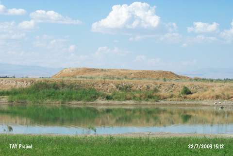 |
|
Type:
|
Mound |
|
Altitude:
|
680 m |
|
Region:
|
Eastern Anatolia |
|
Province:
|
Malatya |
|
District:
|
Battalgazi |
|
Village:
|
Hasircilar |
|
Investigation Method:
|
Survey |
|
Period:
|
EBA III |
|
|
|
 |
|
| It lies about 1 km west of the Kirkgöz Bridge over the Tohma Stream; north of Malatya Province. It is a small mound located on the western bank of the stream. It measures 5 m in height and 50 m in diameter. It is surrounded by natural hills named as Hasirci 2; 3 that makes it difficult to locate. Very restricted number of material was collected from the surface. Sherds of painting decorated ware dating from the EBA were recovered. Another survey is necessary. It is called Yakar and Salzmann Höyük or Hasircilar. It takes place in the registered archaeological sites list prepared by Ministry of Culture and Tourism. |
| Location: |
| Geography and Environment: |
| History: |
| Research and Excavation: |
| Stratigraphy: |
| Small Finds: |
| Remains: |
| Interpretation and Dating: |