|
©The Archaeological Settlements of Turkey - TAY Project
|
|
|
|
|
|
Harnoba |
|
|
For site maps and drawings please click on the picture... 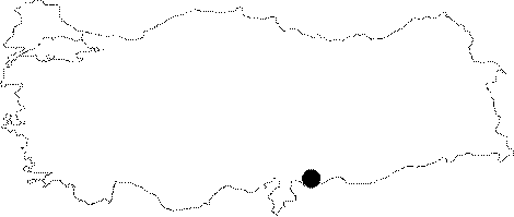 |
For photographs please click on the photo...  |
|
Type:
|
Single Findspot |
|
Altitude:
|
m |
|
Region:
|
Southeastern Anatolia |
|
Province:
|
Gaziantep |
|
District:
|
Akçakoyunlu |
|
Village:
|
Harnoba |
|
Investigation Method:
|
Survey |
|
Period:
|
ÜP |
|
|
|
 |
|
| Location: This site lies 15 km southeast of the city of Gaziantep; in the Tilbasar Plain; 11 km north of the town of Akçakoyunlu. |
| Geography and Environment: Çiner provides no further information on the location of this site. |
| History: |
| Research and Excavation: The site was discovered by Refakat Çiner during her 1950 survey of the Gaziantep region. The exact location of the site is not described in the publication nor is it represented in the accompanying map. |
| Stratigraphy: |
| Small Finds: In his survey; Çiner found one Aurignacien tool that she assigned to the Upper Palaeolithic Period. No photo or drawing of the tool is published. |
| Remains: |
| Interpretation and Dating: |