|
©The Archaeological Settlements of Turkey - TAY Project
|
|
|
|
|
|
Harmanyeri |
|
|
For site maps and drawings please click on the picture...  |
For photographs please click on the photo... 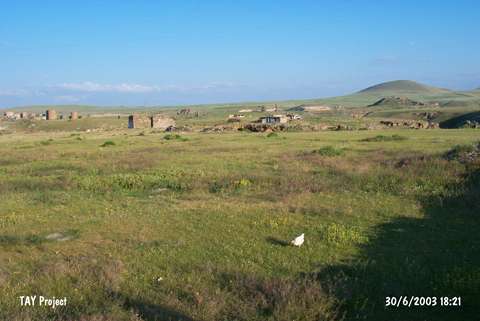 |
|
Type:
|
Cemetery |
|
Altitude:
|
1500 m |
|
Region:
|
Eastern Anatolia |
|
Province:
|
Kars |
|
District:
|
Merkez |
|
Village:
|
Ocakli |
|
Investigation Method:
|
Excavation |
|
Period:
|
|
|
|
|
 |
|
| It lies on a threshing field; south of Ocakli (Ani) Village; Arpaçay District; northeast of Kars Province. To the south flows the Bostan Stream joining the Arpaçay [Balkan-Sümer 1967:map.2]. Although it was flattened for threshing; it still looks like a small mound. It was discovered by K. Kökten who conducted soundings followed by K. Balkan (1964-1965). Sherds identified by K. Kökten as the Copper Age ware were collected. Most of them are produced of exteriorly and interiorly black washed and burnished ware with a thin paste. Also found is the matte-red pottery. When the continuation of such wares from the Karaz Culture to the late periods in Eastern Anatolia is taken into consideration; the dating of those materials should be done carefully. During the Balkan's excavations; simple stone graves were found in addition to the cist graves and stone cellar graves. It was observed that the grave with rough stone walls erected in a rectangular form with round corners by a dry-wall technique yielded copper/bronze bracelets; necklaces; funnel-shaped objects and vases left as grave goods. It is reported that the burial went under cremation. Of the vessels; there are some samples of the black burnished ware akin to the Karaz ware. It takes place in the registered archaeological sites list prepared by Ministry of Culture and Tourism. |
| Location: |
| Geography and Environment: |
| History: |
| Research and Excavation: |
| Stratigraphy: |
| Small Finds: |
| Remains: |
| Interpretation and Dating: |