|
©The Archaeological Settlements of Turkey - TAY Project
|
|
|
|
|
|
Harif Pinar |
|
|
For site maps and drawings please click on the picture... 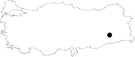 |
For photographs please click on the photo...  |
|
Type:
|
Flat Settlement |
|
Altitude:
|
670 m |
|
Region:
|
Southeastern Anatolia |
|
Province:
|
Batman |
|
District:
|
Kozluk |
|
Village:
|
Yayageçer |
|
Investigation Method:
|
Survey |
|
Period:
|
Aceramic |
|
|
|
 |
|
| This site lies north of the city of Batman; west of the town of Kozluk; in Yayagecer (Dehikan) Village. The survey code of the site is T 56 / 28. The site lies on the eastern bank of Hiyan Stream. Further information on the location of the site has not been provided. The site was discovered in 1990 during the survey conducted by M. Rosenberg and H. Togul of the area expected to be flooded by the Batman Dam Lake; in the Sason; Hilyan and Ramdenka Stream Valleys. Many flint and obsidian chipped stone tools were collected from the surface of the mound. The researchers have assigned these finds either to the Epipalaeolithic or to the Aceramic Neolithic Periods. |
| Location: |
| Geography and Environment: |
| History: |
| Research and Excavation: |
| Stratigraphy: |
| Small Finds: |
| Remains: |
| Interpretation and Dating: |