|
©The Archaeological Settlements of Turkey - TAY Project
|
|
|
|
|
|
Hamidiye - Nazilli |
|
|
For site maps and drawings please click on the picture...  |
For photographs please click on the photo... 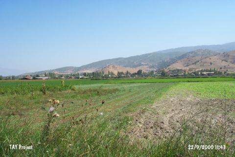 |
|
Type:
|
Mound |
|
Altitude:
|
60 m |
|
Region:
|
Aegean |
|
Province:
|
Aydin |
|
District:
|
Nazilli |
|
Village:
|
Hamidiye |
|
Investigation Method:
|
Survey |
|
Period:
|
Ceramic |
|
|
|
 |
|
| This site lies east of the city of Aydin; approximately 500 m east of the village of Hamidiye; along the road (on the southern side) that turns off the main road and heads to the village. The site is far from the Maeander River but there are other nearby water sources. The site was discovered by D.H. French during his 1960 surface survey. In addition to Neolithic; Late Chalcolithic and Early and Middle Bronze Age finds have been found. The plain burnished; chaff tempered; handmade Neolithic ceramics have red and occasionally gray or black slip. In western Anatolia; this type of ware is dated to the Late Neolithic Period. |
| Location: |
| Geography and Environment: |
| History: |
| Research and Excavation: |
| Stratigraphy: |
| Small Finds: |
| Remains: |
| Interpretation and Dating: |