|
©The Archaeological Settlements of Turkey - TAY Project
|
|
|
|
|
|
Hamam |
|
|
For site maps and drawings please click on the picture...  |
For photographs please click on the photo... 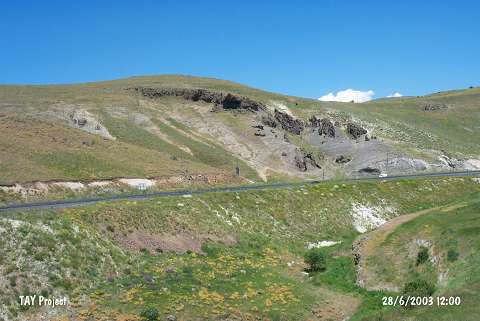 |
|
Type:
|
Rock Shelter |
|
Altitude:
|
1980 m |
|
Region:
|
Eastern Anatolia |
|
Province:
|
Erzurum |
|
District:
|
Merkez |
|
Village:
|
Nenehatun |
|
Investigation Method:
|
Survey |
|
Period:
|
|
|
|
|
 |
|
| It is located 1.5 km east of the village of Nenehatun in the province of Erzurum. Erzurum - Pasinler (Hasankale) motorway passes from the immediate south of the site. The shelters are on the rocky hills that lie towards north on the 12th km of the motorway. It was investigated by A. Ceylan of Atatürk University during the survey of Erzincan; Erzurum and Kars provinces and recorded as Hamamderesi Kaya Odalari. It is reported that the rock shelters belong to the Middle Ages and Palaeolithic material was also encountered. |
| Location: |
| Geography and Environment: |
| History: |
| Research and Excavation: |
| Stratigraphy: |
| Small Finds: |
| Remains: |
| Interpretation and Dating: |