|
©The Archaeological Settlements of Turkey - TAY Project
|
|
|
|
|
|
Kinik Höyük |
|
|
For site maps and drawings please click on the picture...  |
For photographs please click on the photo... 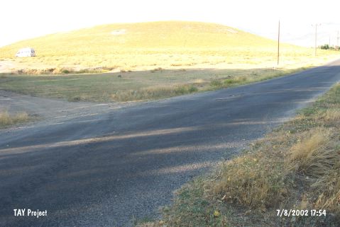 |
|
Type:
|
Mound |
|
Altitude:
|
1150 m |
|
Region:
|
Central Anatolia |
|
Province:
|
Nigde |
|
District:
|
Bor |
|
Village:
|
Bayat |
|
Investigation Method:
|
Excavation |
|
Period:
|
|
|
|
|
 |
|
| Location: It is located in Nigde Province, at the entrance of Altunhisar Valley on the skirt of Melendiz Mountains, in the northeast section of Konya Plain. |
| Geography and Environment: It is located at the foot of Mount Melendiz. The site consists of 20 m high mound with a diameter of 180 m. It is set on a terrace covering roughly 300 square meters. |
| History: Meriggi stated that Kınık Höyük was the same city with Uda mentioned in the Hittite incriptions and the city of Hyde referred in the later texts. It was suggested that Kınık Höyük was mentioned in the name of Dratai in the written documents belonging to the Hellenistic Period. This name was referred as Frourion Drizion or Idrizion in Byzantine sources. It was believed that the city was mentioned as Tracias in Tabula Peutingeriana, a famous Roman map. All of these suggestions are still open for debate [d'Alfonso-Isikli 2012:18, 20]. |
| Research and Excavation: The site was identified during the survey carried out by a team from the University of Pavia in 2006-2009. The excavation studies were initiated by the University of Pavia and New York University in 2011 with the participation of the University of Nigde and University of Erzurum. The 2011 campaign was directed by L. d'Alfonzo from the New York University and M. Isikli from the University of Erzurum [d'Alfonzo 2013:387]. |
| Stratigraphy: Period I: Middle Ages Period II: Hellenistic (4th-1th century BC) Period III: Achaemenid (6th-4th century BC) Period IV: Late IA I (7th-6th century BC) Period V: Middle IA (9th-8th century BC) Period VI: Early IA (11th-10th century BC?) Period VII: LBA [D'alfonso et al. 2016:302], [https://kinikhoyuk.org/excavations.html,12.09.2019, 16:11]. |
| Small Finds: Architecture: In 2011, three areas were opened and these areas were labeled A, B and C. Area A and C, where the citadel walls were investigated, are located on the northern and the southwestern slopes of the mound. Area B was opened on the top of the mound and the large stone structure indicated by the GPR was investigated in this area. Operation B consists of three squares and two levels corresponding to the most recent period of the site's occupation were uncovered. Level B1 is represented by a room (Room 1) found on the eastern edge of the excavated area. Level B2 consists of remains of domestic architecture and an open working area. It is built of two-row walls with thickness of 70-90 cm. The walls are preserved up to 50 cm high. They're quite irregular and constructed of unshaped stones bound with clay mortar. The stone walls defining two rooms of a building were discovered in the northernmost square. The eastern room (Room 2) with a surface of nine square meters has been completely excavated. Level B2 is cut by several modern pits. Therefore, it is difficult to understand the architecture. The central section of Operation B is characterized by retaining walls and installations the function of which are difficult to determine. In the southern section, alignments of stones and pieces of wall possibly formed a small building complex associated to a court with a central pithos were recovered. Operation A is located on the northern slope of the mound just above the edge of a huge pit used in modern times as a stone quarry. After removing the topsoil, an accumulation of repositioned mudbricks was reached. In this accumulation, a pit was cut. Under this accumulation, stone masonry belonging to the citadel's fortification wall was found. This structure extends in the east-west direction and measures over four meters in width. At the end of the 2011 campaign more than five meters of the outer face of the wall were exposed. The foundations of the wall were not yet reached. The wall has two main phases. Inner and outer faces of the wall were built with large unshaped stones, while smaller stones were used in the center of the wall. A clay mortar was used to stabilize the structure. About three meters under the top of the wall a slanting clay rampart associated with the wall plaster was discovered. Under this rampart two more meters of stone masonry were exposed. Those were built with slightly smoothed blocks with diameters of about 50-60 cm and were not covered by plastering. The citadel walls were also investigated in Operation C, on the southwestern slope of the mound. Four soundings were opened in order to keep the walls in the best state of preservation. In the soundings 1, 2, and 4 the floors were associated with mudbrick and stone architecture remains were found [d'Alfonzo 2013]. During the studies carried out in Area A in 2012, remains dating to the Hellenistic Period were exposed. Beneath this level, four building levels belonging to Late IA were determined. This occupation dated to Late IA corresponds to Level III which is dated to approx. 700-400 BC. The building level A2.2 consists of a production area that includes hollow ovens and rubbish pits. The installations yielded pottery slags and organic residue. A series of neatly made clay floors relating to a poor architecture were found in the building level A2.3. The holes placed at intervals might have been used for wooden posts. Ash remains and a great number of painted potsherds dating to late 7th and 6th century BC were found on the last one of these floors. The building level A2.4 and A2.5 yielded similar remains like the ones found in the previous building level. Therefore, it is possible to date this level to the 7th century BC. The structure found in the building level A2.4 should be special. Despite its walls were built in traditional technique, the outer and inner surfaces of the walls were White plastered. Some parts were probably painted. Traces of red bands were seen on the white plaster. The walls and floors exposed in the building level A2.5, which is located below, share similarities to the ones found in the building level A2.4 in terms of technique. However, these walls and floors were not plastered in white. The function of this structure is different. A group of pithoi aligned along the east wall was found. Two of them, which are located next to the stone pavement, were placed into the clay floor. If not the structure functioned as a communal building; the remains recovered inside the structure indicate that the structure might have functioned as a store room related to a large house. The citadel walls exposed in the building level A2.6, which is contemporary with the building level A1.4, measure over 4.5 m in width. The construction technique of the walls is unique for the pre-classical period of Anatolia. The walls were built with amorphous stones with a diameter of about 30-35 cm. A test pit with a depth of 2 m was opened in the outer face of the walls. Although the foundation of the walls has not yet been reached, the walls exposed in this area were preserved up to over 5 m high. Two phases were defined in this building level. In the lower phase, larger stones were used. Due to the fact that the limited data have been obtained so far, it is not yet possible to determine the date of both phases. The citadel walls unearthed on the northern slope extend 15 m in the east-west direction [d'Alfonso-Ergürer 2014]. In 2013, Area A, B and C were excavated. Midden fill consisting carbonized materials and bone fragments was exposed below Level B3 and B4 belonging to Hellenistic Period in Area B. This fill is located on top the soil layers related small sized ovens and architectural features and represent the transition period between Late IA II and Hellenistic settlements. After removal of these fills, the upper section of the mudbrick wall, some parts of which was discovered in the deep trench in 2011, was reached. The thickness of this wall is 1 m. It was built with three rows of mudbrick. It measures over 10 m in length. This wall forms the north wall belonging to the large room extending in the east-west direction. The room was partially excavated and heavily damaged by the pits dated to Middle Age and Hellenistic. A deep trench was opened at the northeast corner of the room. However, the floor of the room has not been reached. A mudbrick structure in round plan and an architectural feature, which was probably used for refuse materials, were found below two clay floors representing the last phases (level B5 and B6) of the room. The corners of that architectural feature are bordered with two walls. The refuse fill yielded Late IA II (Akhamenid Period) potsherds that are commonly seen in Level III. During the studies carried out in Area A, a square shaped, stone paved floor that covers an area of 9 square meters belonging to Level A2.4 was exposed. It is possible to date these levels to the 8th and 6th century BC. In 2013, two ramparts were excavated. The earliest rampart has damaged the walls belonging to the early phase and the walls protruded from the plaster. In the later phase, the rampart became more upright and it was raised [d'Alfonso et al. 2015]. During the 2014 studies, Level A2 was reached under the clay floor A1534 in S17.3 in Sector A1. In 2014, the excavation of the buildings that were exposed during the previous years was continued in Operation A2, Sector A2. These buildings are dated to Late IA I, Level A2.3. The excavations extended southward and the floor A282 was removed. Another floor, A1215, was exposed below it. This floor is also dated to Late IA I based on the pottery sherds. This floor is related with a large court called Room 1. The northern wall of this court was covered with white-painted plaster. The walls bordering the court exhibit multiple phases of construction. The court is accessible through a large passage on the southwestern corner. Three floors in total were exposed in this court and all of them yielded very few materials dating to Late IA I and Middle IA. The existence of three pithoi sherds found on the floors indicates that the court may have used as a storeroom. In 2014, the studies continued in the mudbrick building dating to the Achaemenid Period in Operation B2. It has several phases (Level B5-7). Mudbrick walls B397 and B673 were exposed in 2013 and they are the common features of all three phases. These walls are about 2 m high and 1 m wide. There are some traces of colored plastering. The latest phase of this building is defined by two walls (B815 and B892). These walls join with B397 and B673 and form a large trapezoidal room (Room 7). This room measures about 10x3-4 m. Below it, Level B6 yielded a wall named B897. The wall, comprising a stone foundation and mudbrick superstructure, is covered with a thick layer of plaster. The earliest floor of Level B6 yielded an oven (B2001) together with a lateral stone installation. A mill was found on the northwest corner of the room. The presence of a mill, oven and several ashy fireplaces indicate that this space was related with food preparation during Level B6. [D'alfonso et al. 2016; https://kinikhoyuk.org/excavations.html, 12.09.2019, 16:11]. Pottery: It is possible to date the pottery found in Level B2 in Operation B to the Medieval Period. There are also Hellenistic sherds among the potsherds recovered from Operation B. The pottery sherds found in the soundings opened in Operation C can be primarily dated to the Middle to Late Iron Age. These potsherds consist of black-on-white and black-on-red painted pottery with geometric patterns, such as zigzag lines, triangles, crosses and patterns composed of bows, parallel dashes and wavy lines. A fragment of a carinated cup with an applied deer motif was also found in sounding 4 in Operation C. This deer motif represented in a clear silhouette style resembles the ones found in Alishar IV and it is also known from many sites of Central Anatolia, from Alishar to Bogazköy and closer to Kinik Höyük, Porsuk and Kamankale Höyük [d'Alfonzo 2013:392]. The potsherds dated to the Middle IA share similarities to the ones found in Porsuk-Zeyve and Kamankale. The majority of these Middle IA vessels are wheel-made. These vessels comprise of buff colored monochrome pots, the rims of which bear geometric motifs. The most common forms are bowls and cooking pots. It was observed that the decoration style of Late IA pots was changed. Vessels painted bichrome or polychrome inside white metopes were seen in this group [d'Alfonso-Ergürer 2014]. Clay: A red painted base of a terracotta statuette was found on the floor (A1548) belonging to Level A1.2 of Operation A1. The production technique, fabric and decoration are similar with the two bases of zoomorphic vessels found in 2013 likely dating to the Late Achaemenid Period [D'alfonso et al. 2016:305]. Human Remains: The pit opened in the accumulation in Operation A contains a simple east-west oriented burial in very poor condition. Grave goods consisting of a necklace made of glass beads of different colors, sizes and shapes, placed inside of a clay vessel were also found. The glass beads are all rod-shaped and decorated with color applied bands or pellets [d'Alfonzo 2013:390]. Flora: Among the floral remains recovered from the building level A2.2 in 2012, charcoal, grains of barley and wheat, rachis fragments, grape seeds and stalks were defined [d'Alfonso-Ergürer 2014]. During 2014 studies, a total of 58 samples were collected from different contexts. Samples from Late IA showed the highest proportion of cereal remains. Samples belonging to Late IA contain a large number of grape seeds and pedicels [D'alfonso et al. 2016:320-322]. |
| Remains: |
| Interpretation and Dating: It seems that the mound and the terrace constitute the center of the site but the abundance of pottery sherds collected in the surrounding fields indicates the existence of a large lower town. The potsherds collected during the intensive survey show that the site have been occupied from the EBA through the Middle Ages. However, considering the number and distribution of the potsherds, it seems that the major occupation phase of the site corresponds to the Iron Age [d'Alfonzo 2013]. |