|
©The Archaeological Settlements of Turkey - TAY Project
|
|
|
|
|
|
Hacilar Höyük |
|
|
For site maps and drawings please click on the picture...  |
For photographs please click on the photo... 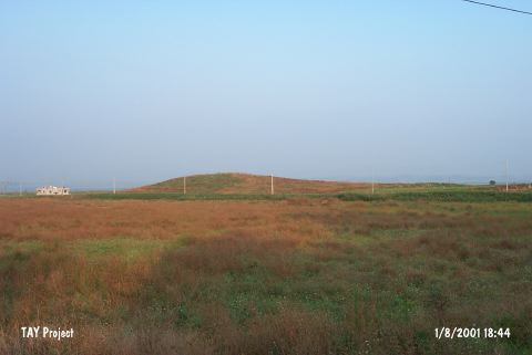 |
|
Type:
|
Mound |
|
Altitude:
|
90 m |
|
Region:
|
Mediterranean |
|
Province:
|
Adana |
|
District:
|
Ceyhan |
|
Village:
|
Merkez |
|
Investigation Method:
|
Survey |
|
Period:
|
Ceramic |
|
|
|
 |
|
| This large mound site lies at the entrance of the Kürtkulak Valley; in Namik Kemal Quarter; 1 km south of the town of Ceyhan; east of the city of Adana. As a result of plowing and erosion; the upper part of the mound has been destroyed and the site has become a low mound that gently rises above the plain it lies on. The site discovered by J. Garstang in 1937 was researched by M.V. Seton-Williams in 1951. In addition to Late Neolithic and Chalcolithic (Ubaid) type ceramics; the site yielded Iron Age; Roman and Byzantine material. Pre-Halaf painted pottery; assigned to the Late Neolithic and Early Chalcolithic periods; was found at Yumuktepe levels XXVI-XXIV. In ASPRO; the site has been placed into Phase 6. Because the Chalcolithic levels are high up on the mound; the Neolithic layers are believed to be thick. It takes place in the registered archaeological sites list prepared by Ministry of Culture and Tourism. |
| Location: |
| Geography and Environment: |
| History: |
| Research and Excavation: |
| Stratigraphy: |
| Small Finds: |
| Remains: |
| Interpretation and Dating: |