|
©The Archaeological Settlements of Turkey - TAY Project
|
|
|
|
|
|
Hacafer |
|
|
For site maps and drawings please click on the picture...  |
For photographs please click on the photo... 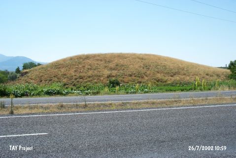 |
|
Type:
|
Mound |
|
Altitude:
|
1095 m |
|
Region:
|
Central Anatolia |
|
Province:
|
Kayseri |
|
District:
|
Incesu |
|
Village:
|
Merkez |
|
Investigation Method:
|
Survey |
|
Period:
|
|
|
|
|
 |
|
| It lies immediate south of Incesu-Nevsehir motorway; 600 m north of the train station of Incesu District of Kayseri Province. Approximately 8-10 m high mound was observed by D. French and dated to EBA according to the collected material. It was discovered during the survey conducted by Kulakoglu and his team in 2010. On the surface, EBA sherds were seen as well as MBA and IA sherds [Kulakoglu et al. 2012:221]. |
| Location: |
| Geography and Environment: |
| History: |
| Research and Excavation: |
| Stratigraphy: |
| Small Finds: |
| Remains: |
| Interpretation and Dating: |