|
©The Archaeological Settlements of Turkey - TAY Project
|
|
|
|
|
|
Göltepe |
|
|
For site maps and drawings please click on the picture... 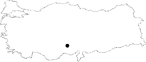 |
For photographs please click on the photo...  |
|
Type:
|
Workshop |
|
Altitude:
|
1760 m |
|
Region:
|
Central Anatolia |
|
Province:
|
Nigde |
|
District:
|
Çamardi |
|
Village:
|
Celaller |
|
Investigation Method:
|
Excavation |
|
Period:
|
|
|
|
|
 |
|
| Location: It lies 1.5 km southwest of the Celaller Village; 4 km southwest of the Çamardi Village; about 30 km southeast of the Nigde Province [Yener-Earl 1994:map at 169]. |
| Geography and Environment: Between the natural hill called Göltepe and the mine quarry of Kestel on the north lies a shallow slope. Göltepe measures ca. 65 ha [Yener 1995:fig 1]; and it is reported to have a Neogen formation consisting of sandy stone; limestone and clay [Drahor 1993:40] [Ozaner 1993:472). The strata on the hill extend to east and southeast with an inclination degree of 30-40. There are plenty of fresh water springs in the vicinity. It is reported that the total settlement area is ca. 8-10 ha. including 5 ha. inside the fortification walls of the EBA village itself and 3-5 ha. outside the walls. |
| History: |
| Research and Excavation: The excavations initiated under the direction of K.A. Yener in 1990 were finalized in 1994. Göltepe was not only subject to archaeolological excavations but it was also assessed in terms of its mining history, and the mining work in the village were investigated in detail. A total of 36 small test trenches were opened in various sizes for this purpose. Furthermore, very large areas were dug horizontally near the surface to find out the settlement plan. And, the architectural remains in non-excavated areas were archeogeophysically studied [Drahor 1993:39-47], [Esin 1998:122]. It is listed among the registered archaeological sites by the Ministry of Culture and Tourism. |
| Stratigraphy: As mentioned by K.A. Yener, 4 phases of settlements were identified as of 1993; Phase 1: A long period of time after the uppermost phase was abandoned by the first settlers, it was inhabited again by Iron Age miners. Phase 2: It is the Early Bronze Age phase III settlement as identified by the excavation director based on the presence of red washed and burnished ware and the Syrian bottle of metallic ware. Phases 3-4: Again according to the head excavator, Göltepe had been initially inhabited during these phases dated to the EBA II [Yener 1995:180-182]. It is likely the first settlement at Göltepe was around 2.600 BC. |
| Small Finds: Architecture: The people who came to work at the Kestel stannary built their barracks and founded their village on the hill presently known as Göltepe. In order to protect their settlement, they also built the fortification wall using large stone blocks from the mine which were preserved to date up to a height of 1 m [Yener 1992:278]. It is assumed the walls defended an area approximately of 12 acres. M. Drahor proved that the wall extensions actually did not enclose the entire hilltop [Drahor 1993:46]. An entrance gate was identified in the wall. In addition to the stones from the quarry, all kinds of material collected in the area were used for the construction of the walls which were founded by splitting the bedrock. Besides irregular stones, the stones with a cavity on their surface which were used for the enrichment of the mine were also placed inside the walls after the completion of their function [Yener 1995:180]. Besides, some terrace walls were also identified. Presence of buildings used both as a workshop and a residence is proposed. They are round, oval, heptagonal and rectangular pit-like barracks. The smallest of them is 2x3 m, and the largest is 5x7 m. The barrack occupying the pit was of wattle. The buildings were plastered with clay inside and out. An irregular shaped multi-room underground building was found carved into the bedrock in the southwestern terrace. It has nine rooms. The building was composed by carving the bedrock approximately 1-4 m deep. This structure was dated to EBA phase II. The building was presumably covered with a roof made of wood, thatch and mud. It contains hearth and klinae. Presence of a thatched roof cottage plastered with mud can be suggested based on the crescent moon shaped wood inside the holes on the bedrock, the type and size of the burnt wooden remains, the burnt mud remains to the south of the hill, where the head excavator called the "southern peak". Based on the finds, this building can be dated to the EBA phase II. The corrected 14C dating on the samples collected from the ground was 2.865-2.495 (2.451-2.040 w/out correction). There are many deep and shallow pits containing underground buildings on the southern peak of the hill [Yener 1995:pic.2]. As observed, the workshops are denser in this area. There are small underground rooms and cells on the southern peak as well. An infant burial was found, but its period was not identified. At the peak, the stones were lightly carved to place the foundation of a stone wall building. This building contains clay plate with relief in the deposit inside the building and on the floor, and it was dated to the EBA phase III [Yener 1992:277, fig.2]. There are coarse stones in the room for mine enrichment, melting pots with tin cinder inside, casting molds, a large number of sherds and obsidian tools. Pottery: Thousands of sherds were collected which belonged to people that lived in this miners' village. Among them are weighing vessels with a single handle as well as imported Syrian type bottles and vessels. The number of intact vessels is very small. Industry that belong both to EBA phase II and III was encountered. Sherds of plain ware, red coated, grit tempered ware, grey-black burnished ware were found. The aubergine color painted Anatolian metallic ware vessel typical to Konya and Toros region was also unearthed. Clay: The function of the clay panel decorated with geometric figures is uncertain [Yener 1995:drw.3B]. The most important clue about intense mining activities in the village is the hundreds of melting pots. The interior surface of some of these pots were covered with a layer of slags. It was found out that they are tin slags [Yener 1993:235]. Alos founda are a small number of clay spindl whorls. Chipped Stone: Although no information is available about the industry, presence of flintstone and obsidian as raw material is known [Yener 1993:235]. Grindstone: Mortars made of andesite, gabbro, diorite and quartz, grindstone, multi-cavity mortar, ore mortar and other tools for ore enrichment [Yener 1993:fig.7], hematite loom weights, burnished hammer axes [Kaptan 1990:20, pic.16], beads made of various stones were unearthed. Two-piece mould fragments made of sandstones were also found. They were presumably used for casting ingots. Bone/Antler: Hundreds of bones belonging to livestock animals were collected from one of the dump pits of the lower phases. They were probably stored here for a reason. There are a limited number of bone pins. Metal: Göltepe was a mining village, but restricted number of metal finds contradicts with the importance of this area. A mace head pin resembling the ones at the Mari Er Dynasty Period was found in EBA phase II. Presence of copper pin, awl, hanger, spiral earring is reported. The iron axe found inside EBA level should have mixed from the upper level. If it belongs to this level, then it will be the second most important iron find after the dagger at Alacahöyük. Animal Remains: It was found out that the people who lived in the Göltepe barracks, and probably the mine owners had pets. |
| Remains: |
| Interpretation and Dating: It was ascertained that the people involved in tin mining in Kestel/Sarıtuzla at Göltepe during the EBA, second half of the 3rd Millennium BC, founded the village. There is 1% cassiterite inside the iron ore dust stored in the workshop and the houses. According to the tin expert B. Earl, who joined the excavation team in 1992, this cassiterite (tin ore or tinstone) was enriched through a basic process and a bead formed tin was obtained after melting in the pot and poring into molding [Yener 1994:203]. It is assumed that during the prehistoric age this was the procedure for obtaining and forming the tin. Another important fact about Göltepe, is that it is identified as the first mining village in Anatolia. 50.000 jigs were found in this area [Kaptan 1995:193]. It may be claimed that the Göltepe miners were the pioneers of the transition from the arsenic bronze to tin bronze period in Anatolia in terms of mining history. Experts also argue that mining at Kestel may have been initiated for finding a metal other than tin. Some scientists indicate that since tin was imported to Anatolia during the early 2nd Millennium BC, tin to be obtained from Kestel must have been very poor in amount. |