|
©The Archaeological Settlements of Turkey - TAY Project
|
|
|
|
|
|
Güzelce |
|
|
For site maps and drawings please click on the picture...  |
For photographs please click on the photo... 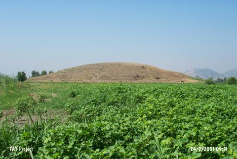 |
|
Type:
|
Mound |
|
Altitude:
|
135 m |
|
Region:
|
Mediterranean |
|
Province:
|
Hatay |
|
District:
|
Kirikhan |
|
Village:
|
Güzelce |
|
Investigation Method:
|
Survey |
|
Period:
|
|
|
|
|
 |
|
| It lies west of the motorway; north of Güzelce Village; northeast of Kirkhan District of Hatay Province. It is located on the eastern bank of the Karasuyu Stream. It is a medium sized mound and it is steep. Small streams flowing down from the Gavur Mountain met the water requirements of the inhabitants. Sherds of EBA; yet not certain; were collected from the surface. It is surrounded by fertile fields. Sherds dating from the second millennium BC and the Middle Age were recovered. Further investigation is necessary for the EBA finds. It takes place in the registered archaeological sites list prepared by Ministry of Culture and Tourism. |
| Location: |
| Geography and Environment: |
| History: |
| Research and Excavation: |
| Stratigraphy: |
| Small Finds: |
| Remains: |
| Interpretation and Dating: |