|
©The Archaeological Settlements of Turkey - TAY Project
|
|
|
|
|
|
Gümüsdere - Kilyos |
|
|
For site maps and drawings please click on the picture... 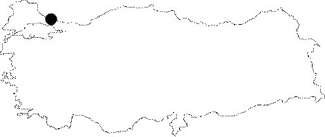 |
For photographs please click on the photo...  |
|
Type:
|
Habitation Site / Workshop |
|
Altitude:
|
m |
|
Region:
|
Marmara |
|
Province:
|
Istanbul |
|
District:
|
Kemerburgaz |
|
Village:
|
Gümüsköy |
|
Investigation Method:
|
Survey |
|
Period:
|
OP ÜP EP |
|
|
|
 |
|
| Location: This site is 26 km north of Istanbul's Eminönü district; 4 km west of the town Kilyos; between Agaçli and Kilyos and 2 km northeast of the village of Gümüsdere/Gümüsköy. The site extends over a large area on the Black Sea shore which includes the dunes smaller than the Agacli dunes such as the Kilyos dune which is north of Kumköy and east of the Gümüsdere dune. Its survey code is 13 / 14. |
| Geography and Environment: The sand-dunes that collectively make up the site are sandwiched between the Black Sea to their north and forests to their south. The Domuzdere Stream Terraces and the sand-dunes on the banks of the narrow valley between the Domuzdere and Gümüsdere Streams yielded chipped stone tools. This area and the forested region south of it must have been climatically and environmentally very suitable for seasonal hunter-gatherers during the Ice Ages and in the later Holocene. Research reveals that; similar to the site of Agaçli; the oldest reddish sand-dunes with solidified deposits yielded the most finds. Although the newer yellowish dunes have been deposited over the older red ones; powerful winds have uncovered the oldest; solidified redder dunes; exposing Palaeolithic campsites. The campsites are less frequent here than at the Agaçli dunes. The finds include flint tools and debitage products. Some of the larger stones may have been used to support posts. If the older Gümüsdere dunes do not get destroyed by the coal mining activity in the region; many more Palaeolithic campsites may be exposed as the wind shifts the newer overlying dunes. |
| History: |
| Research and Excavation: The site was discovered by Mehmet Özdogan and S. Harmankaya of the University of Istanbul; Faculty of Letters; Prehistory Section in 1974. Research in the area continued in 1975 and 1980 as part of Özdogan's collective surveys of Thrace [Özdogan 1982:48; Özdogan 1983b:411; Özdogan 1983a:137]. |
| Stratigraphy: |
| Small Finds: Güven Arsebük; who analyzed the tools which were collected by the students and faculty of the Prehistory Section of Istanbul University; believes that although the finds are Upper Palaeolithic in character; they are under the influence of a local Middle Palaeolithic tradition. The Lower Palaeolithic chopping-tool-like core tool found at this site is thought to have been carried to this location by natural causes [Esin 1992:64). Many microlith-type blade cores; backed bladelets and other micro-blades found on the Gümüsdere and Domuzdere dunes indicate that this area was used as an open air campsite and habitation area for Epipalaeolithic hunter-gatherers [Özdogan 1982:fig. XV; fig. 8; Özdogan 1983a:fig. 2; Esin 1992:fig 3/29-33; Gastov-Özdogan 1994:106-107]. More systematic surveys; need to be carried out in the older dunes in Gümüsdere before the site is completely destroyed. The site dates to the end of the Upper Palaeolithic and to the beginning of the Epipalaeolithic Periods. Some scattered chipped stone tools were also found in the Kilyos dunes [Özdogan 1985:map of fig.1]. |
| Remains: |
| Interpretation and Dating: |