|
©The Archaeological Settlements of Turkey - TAY Project
|
|
|
|
|
|
Aktil Köy |
|
|
For site maps and drawings please click on the picture...  |
For photographs please click on the photo... 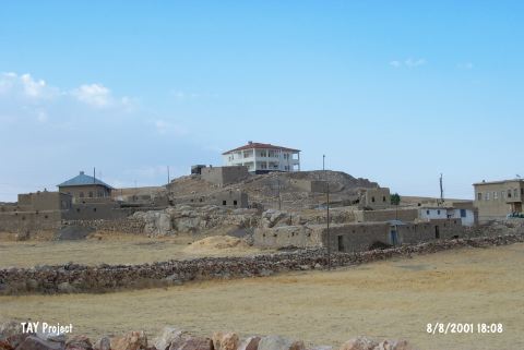 |
|
Type:
|
Mound |
|
Altitude:
|
1730 m |
|
Region:
|
Eastern Anatolia |
|
Province:
|
Kahramanmaras |
|
District:
|
Elbistan |
|
Village:
|
Yalintas |
|
Investigation Method:
|
Survey |
|
Period:
|
Late |
|
|
|
 |
|
| The mound lies in Yalintas (Aktil) Village; northeast of Elbistan District of Kahramanmaras Province. Southeast of the mound passes the road to Bestepe Village and south passes the one to the Inecik Village. The Kocapinar Mevkii east of the mound locates nearby the Malatya border. The site was discovered by A. Dönmez and W. Brice in 1947. Sherds in dark faced burnished ware; matte and coarse unburnished ware were found during the survey. These finds resemble the Amuq Plain E-F phases and probably belong to the Late Chalcolithic Age. Further research is necessary to be conducted. It takes place in the registered archaeological sites list prepared by Ministry of Culture and Tourism. |
| Location: |
| Geography and Environment: |
| History: |
| Research and Excavation: |
| Stratigraphy: |
| Small Finds: |
| Remains: |
| Interpretation and Dating: |