|
©The Archaeological Settlements of Turkey - TAY Project
|
|
|
|
|
|
Göynük Mevkii |
|
|
For site maps and drawings please click on the picture...  |
For photographs please click on the photo... 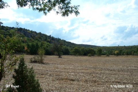 |
|
Type:
|
Habitation Site / Workshop |
|
Altitude:
|
1160 m |
|
Region:
|
Aegean |
|
Province:
|
Kütahya |
|
District:
|
Tavsanli |
|
Village:
|
Ovacik |
|
Investigation Method:
|
Survey |
|
Period:
|
AP |
|
|
|
 |
|
| Location: This site is west-northwest of the city of Kütahya; southwest of the town of Tavsanli and 1 km west of the village of Ovacik; a small village between two hillocks in the undulating plains south of the Tavsanli Plateau. It lies north of the rocky hill to the west of the village. |
| Geography and Environment: The finds; which were spread over a large area; were collected from the rocky outcrop by the stream west of the village. The site is approximately 900-950 m above sea level. The dimensions of the site have not been reported. The geological and environmental setting of the site cannot be determined from the photos in the publication. |
| History: |
| Research and Excavation: The site was discovered by T. Efe during his 1989 Kütahya survey. |
| Stratigraphy: |
| Small Finds: Efe assigns the tools he found at this site to the Lower Palaeolithic. Although further information on the tools is not provided; it is reported that the area is especially rich in flintstone nodules. |
| Remains: |
| Interpretation and Dating: |