|
©The Archaeological Settlements of Turkey - TAY Project
|
|
|
|
|
|
Görmüttepe |
|
|
For site maps and drawings please click on the picture...  |
For photographs please click on the photo... 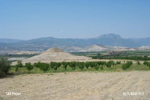 |
|
Type:
|
Mound |
|
Altitude:
|
250 m |
|
Region:
|
Mediterranean |
|
Province:
|
Mersin |
|
District:
|
Mut |
|
Village:
|
Mirahor |
|
Investigation Method:
|
Survey |
|
Period:
|
|
|
|
|
 |
|
| It lies in Dölek Mevkii; 1.5 km south of Mirahor Village; southwest of Mut District of Mersin Province. It is surrounded by rural areas and west of it flows the steam of Göksu. It was discovered by J. Mellaart and dated to EBA. |
| Location: |
| Geography and Environment: |
| History: |
| Research and Excavation: |
| Stratigraphy: |
| Small Finds: |
| Remains: |
| Interpretation and Dating: |