|
©The Archaeological Settlements of Turkey - TAY Project
|
|
|
|
|
|
Göltepe |
|
|
For site maps and drawings please click on the picture... 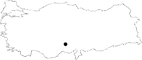 |
For photographs please click on the photo...  |
|
Type:
|
Workshop |
|
Altitude:
|
1760 m |
|
Region:
|
Central Anatolia |
|
Province:
|
Nigde |
|
District:
|
Çamardi |
|
Village:
|
Celaller |
|
Investigation Method:
|
Excavation |
|
Period:
|
EBA II EBA III |
|
|
|
 |
|
| Location: It lies 1.5 km southwest of the Celaller Village; 4 km southwest of the Çamardi Village; about 30 km southeast of the Nigde Province [Yener-Earl 1994:map at 169]. |
| Geography and Environment: Between the natural hill called Göltepe and the mine quarry of Kestel on the north lies a shallow slope. Göltepe measures ca. 65 ha [Yener 1995:fig 1]; and it is reported to have a Neogen formation consisting of sandy stone; limestone and clay [Drahor 1993:40] [Ozaner 1993:472). The strata on the hill extend to east and southeast with an inclination degree of 30-40. There are plenty of fresh water springs in the vicinity. It is reported that the total settlement area is ca. 8-10 ha. including 5 ha. inside the fortification walls of the EBA village itself and 3-5 ha. outside the walls. |
| History: |
| Research and Excavation: The excavation was started in 1990 under K.A. Yener and completed in 1994. The upland of Göltepe was investigated not only in terms of archaeological finds; but also in history of mining in detail. For this purpose; 36 small test trenches were opened in various sizes. Very large areas were excavated horizontally and vertically in order to figure out the settlement plan. The architectural remains in the unexcavated areas were identified by archaeogeophysical explorations [Drahor 1993:39-47]; [Esin 1998:122]. It takes place in the registered archaeological sites list prepared by Ministry of Culture and Tourism. |
| Stratigraphy: As mentioned by K.A. Yener, 4 phases of settlements were identified as of 1993; Phase 1: A long period of time after the uppermost phase was abandoned by the first settlers, it was inhabited again by Iron Age miners. Phase 2: It is the Early Bronze Age phase III settlement as identified by the excavation director based on the presence of red washed and burnished ware and the Syrian bottle of metallic ware. Phases 3-4: Again according to the head excavator, Göltepe had been initially inhabited during these phases dated to the EBA II [Yener 1995:180-182]. It is likely the first settlement at Göltepe was around 2.600 BC. |
| Small Finds: Architecture: Probably the first people who arrived here to run the tin mine of Kestel founded a village on the natural hill of Göltepe. And; then they built the fortification wall by big quarry stones; survived only a portion of 1 m high to the present day; to defend their settlement [Yener 1992:278]. It is suggested that the fortification walls encircles an area of 5 ha. M. Drahor proved that the extensions of the walls do not enclose the hill as a whole [Drahor 1993:46]. The wall was pierced by a gate. During the construction of the wall inserted into the bedrock; every kind of material; aside quarry stones; available in the vicinity were employed. Other than uneven stones; even the hollowed stones used as ore crashing tools were added into the walls after completing their functions [Yener 1995:180]. Some terrace walls were also uncovered. There are structures used as both house and atelier. They are circular; oval; hexagonal or quadrangular pit dwellings. The smallest one measures 2x3 m while the largest one 5x7 m in dimension. The superstructure of the dwellings is wattle and daub. The outer and inner part of the dwellings was coated with clay. On the southwestern terrace; an uneven; multiroomed subterranean structure carved into the rock was revealed. It has nine rooms. It was built by tunnelling the bedrock up to 1-4 m depth. It is also dated to EBA II. The ceiling is suggested to be capped by a framework of timber; reed and loam. Kiln and hearths were uncovered inside. The presence of a thatched wooden hut is suggested based on the semi-circular wooden holes; various sizes and types of burnt wooden remains and burnt loam fragments recovered from the bedrock on the southern part of the hill called south summit by the excavator. It is claimed to datable to EBA II. The calibrated dates of 14C range from 2865 to 2495 BC (uncalibrated 2541-2040 BC). On the southern summit of the hill lie several subterranean structures of deep and shallow pits [Yener 1995:pic.2]. This area is dominated by the ateliers. Also; small underground rooms and cells were uncovered here. An infant burial; the period unidentified; was found. On the summit; a stone walled building was found. Its foundation was slightly carved into the bedrock. This building housing interesting finds like relief clay plate in the deposit and on the floor is dated to EBA III [Yener 1992:277; fig.2]. It yielded rough stones for core crashing; crucibles including residues of tin slags; casting moulds; plenty of sherds and obsidian tools. Pottery: Thousands of sherds were collected varying from single handled balance vessels to imported vessels like Syrian bottles. The number of intact vessels is poor. An industry of both EBA II and III was found. Sherds of the plain ware; the red washed sandy ware; the grey-black burnished ware were collected. Even a vessel of the eggplant colored Anatolian metallic ware typical of Konya and Taurus regions was recovered. Clay: The purpose of geometrically decorated clay panel is unclear [Yener 1995:draw.3B]. The most significant evidence of dense mining activities in the village is the hundreds of crucibles recovered. The interior surfaces of some crucibles are coated with films of slag. The slag is identified as lead [Yener 1993:235]. Limited number of spindle whorls in clay is found. Ground Stone: Several core crashing tools such as mortar; grinding stone and multi-pit grinding stone carved into andesite; gabbro; diorite and quartzite [Yener 1993:fig.7] as well as hematite loomweights and burnished flat axes [Kaptan 1990:20; pic.16] and beads of various stones were recovered. Fragments of double moulds made of sandstone were found. They are assumed to be used for ingot castings. Chipped Stone: Even tough no information was provided about the industry; presence of flint and obsidian is reported [Yener 1993:235]. Bone/Antler: One of the garbage pits in the lower levels yielded hundreds of ox; sheep and goat horns. Probably they were stored here for a specific purpose. Also found is a limited number of bone pins. Metal: Although Göltepe is a mining village; the number of metallic finds recovered constitutes a contradiction. A mace headed pin similar to Mari Early Dynasty Period was found at EBA II. Finds like copper pins; awls; hanger and spiral earring were reported. The iron axe reported to come from EBA layer is; probably; a leakage. If it is actually a find of this layer; this is the second significant iron find recovered from EBA after the dagger at Alacahöyük. Fauna: It is noted that inhabitants of pit dwellings who presumably ran the mines of Kestel had domesticated animals. |
| Remains: |
| Interpretation and Dating: It is certain that Göltepe was established at the second half of the third millennium BC during EBA by the people ran the tin quarry of Kestel/Sarituzla. The iron core powder stored in the ateliers and dwellings includes 1% cassiterite. A tin expert; B. Earl who joined the excavation team; enriched this cassiterite (tin core) by a very simple method and achieved to obtain tin globules inside a new crucible [Yener 1994:203]. The same method was probably applied during the prehistoric era; later on followed by casting it into moulds. Another significance of Göltepe is that it is the first mining village excavated in Anatolia. Nearly 5000 pieces of core crashing tools were found in the vicinity [Kaptan 1995:193]. It can be proposed that miners of Göltepe were pioneers of transition from arsenical bronze to tinned bronze in the history of Anatolian mines. The experts claim that the mine of Kestel; probably; was opened for some other metals except tin. Some scientists indicate that at the beginning of the second millennium BC tin was imported to Anatolia from other regions and the amount of tin was very poor. |