|
©The Archaeological Settlements of Turkey - TAY Project
|
|
|
|
|
|
Acemhöyük |
|
|
For site maps and drawings please click on the picture... 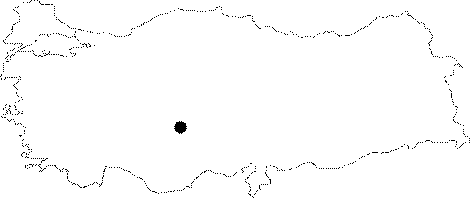 |
For photographs please click on the photo...  |
|
Type:
|
Mound |
|
Altitude:
|
953 m |
|
Region:
|
Central Anatolia |
|
Province:
|
Aksaray |
|
District:
|
Merkez |
|
Village:
|
Yesilova |
|
Investigation Method:
|
Excavation |
|
Period:
|
EBA II EBA III |
|
|
|
 |
|
| Location: It is located within the territory of the Yesilova District; 18 km northwest of the Aksaray Province. It is easily accessible through the Aksaray-Yesilova motorway. |
| Geography and Environment: It looks like a flat hill from a far distance. It is reported to measure ca. 800x700 m in dimensions according to the distribution of the pottery. The size of the EBA settlement couldn't be verified by the researchers. Almost completely obscured by the modern Yesilova houses; it has been saved from the possible damages after the excavation was started. The Melendiz Stream (Uluirmak) originating from the Melendiz Mountain; used to pass by the hill to spill into the Lake Tuz. Today; it disappears in the plain before reaching the lake as it is used for irrigation purposes. |
| History: |
| Research and Excavation: It was excavated by N. Özgüç of Faculty of Language; History and Geography; University of Ankara between 1962 and 1988. The excavation was taken over by A. Öztan from the same faculty in 1989; and it still continues. The recent excavations are focused on Assyrian Colony Period. It takes place in the registered archaeological sites list prepared by Ministry of Culture and Tourism. |
| Stratigraphy: The site had been inhabited from the EBA to the Roman Period. Among others; the settlement of Assyrian Colony Period dating from the first quarter of the second millennium BC is particularly significant with its famous palaces and finds. Because the excavations were targeted revealing the settlements of the second millennium BC; the deeper levels were not excavated extensively. The EBA levels were only reached through a deeper sounding on the east of the mound. The building levels VIII-X uncovered in the trench S are dated to the EBA II-III periods. Depending on the surface finds of the first settlement; it is claimed the first occupation started during the Last Chalcolithic Age [Yakar 1985:199]. |
| Small Finds: Architecture: The excavation yielded a village architecture consisting of mudbrick structures with rectangular or crooked plans from the EBA period. The houses with stone foundations are thought to have flat roofs. The floors are of compressed soil. Because of the lack of an extensive research for areas belonging to this age; the settlement plan is yet to be identified. The excavations were performed on the large plains between the Hatipler monumental palasts north of the mound and Sarikaya which is situated to the south of the mound in year 2005. In this section work was performed in four square plans; three in Sarikaya direction; and one in the east direction in order to identify the south and east elongations of the burnt "Service Building" against the 3rd story of the Assyrian Trading Colony Period. The 1st and 2nd storeys were researched; and in some sections only the 3rd story could be reached. 1st story excavations: A room consisting of mud walls; and a stone foundation was unearthed on the 1st story of Assyrian Trading Colony Period's plan square TA/34. The 1st floor was completely destroyed in the plan square PA-RA-SA/39; because of the village cemetery; but some stone foundation fragments were preserved. Although those did not reveal any plan; it was found that the two streets in northwest and northeast directions of the settlement meet in square RA/39 and form a large square. The residences were built alongside those streets. The street is inclined from north to south direction and paved with small pebbles; sherds; and bones. The streets are only wide enough to allow the pass of one car at a time. The road edges were supported with mid and large size stones in most places [Öztan 2007:550]. The 2nd story buildings in plan squares: PA-SA/39 were built on three blocks; of which one is located between those streets; and the others are located on the eastern and western shores. The elongation of the wall of the single building on the eastern block in square plan SA/39; lying in northeast to southwest direction has a foundation partially supported by stones as in most 2nd story buildings of Acemhöyük. It was separated in three sections but all were destroyed inside due to garbage dump pits of the 1st story. The foundation of the residence in the plan square RA/39 was built with large size rocks; and supported by mid size stones in between them. But the mud walls are not preserved. The house consisting of two consecutive rooms; is in rectangular plan. The entrance is through the patio located on the street to the southwest of the house. The land on which the house was built is delimited by the square on the south direction; and the street on the west direction. It is found that the large section in the shape of a 1/4 circle between the square and the street was used as a patio. There is a platform on the east side of the patio. The plaster of that triangle shaped platform delimited by a row of stones starting from the south of the house door to the garden wall was partially preserved. There is a smaller room made of stones separated from the patio by a wall on the west side of the patio. The fact that there is a tandoor with a well preserved bottom in the middle of the house; shows that this house functioned as a "tandoor house" or an "oven house". The 2nd story buildings in block PA/39 on the west side of the street and the square are in better shape in terms of preservation. There are a total of 8 rooms inside the 3 houses that were unearthed. The 1st house consists of the rooms designated as the 7th and 8th rooms to the southeast of the square. The building with four rooms located to the west of the house; and which surrounds the patio of the 3rd house on the west side; was named the 2nd house. Roughly the two of the four rectangular planned rooms are located in the east and the other two are in parallel; and on the west side. The opening of the horse-shoe shaped kiln on the platform inside 2nd room which has the characteristics of a kitchen faces west just as in the merchant colony city of Kanes (Karum Kanes). The platform made with fist size stones was plastered neatly with mud. The both sides and the mid back side of the opening were heightened and the top was flattened. Another characteristic of the kiln is that it has two buttons inside 6-8 cm in diameter underneath the heightened tips. They were made by rounded sherds plastered with mud above. Those buttons prevent the sliding of the pots inside the kiln; and facilitate the usage of smaller size pots. The third house is located to the west of the street; northwest of the trench. It is observed that the mud walls of the 4th and 5th rooms unearthed in 2005; have foundations partially supported by stones just as in other 2nd story buildings in Acemhöyük [Öztan 2007:551-554]. The remains of Layer I architecture found in the East of Service Building in plan square UA/33 contain wall findings which do not present a plan, represented by small pieces and waste pits. The structures that belong to the late phase of Layer II which is represented in two layers are plan squares UA/32 and UA/33. A corner of a structure is preserved in UA/33 as well as a part of a 2.80 m long structure. Two silos were located in plan square TA/38 among the wall pieces of Phase IIb of Plan Square TA/39 which is opened in 2008. In 2009 it is observed that the silo on the South was located partly above another silo which was on the same area earlier and that almost entire trench was destructed by many waste pits which remained out of the fire ruins. The structures that belong to Phase IIb in the Southern side include the two structures, one passage, other group of rooms, another structure on the South extension and a front yard found in TA/38 and TA/39. Out of the three structures in the Northeast, around half of the structure on the East is opened. Its walls are constructed by a single row of adobe bricks and they are 50 cm thick. Another structure which is in the same level with the Northwest wall of this structure is extending towards Southwest. This second structure's walls are adjacent to the walls of the first structure but they are independent. The walls of the two buildings are closer in the East but slightly separated towards Northwest. A waste pit from the upper layer is located on the middle of Northwest wall of the 4.00 by 3.50 m room (internal measurement) which is slightly trapezium. The plasters preserved around the waste pit show that the entrance of the room was also here. Burnt tree remains are encountered in the room over the floor. The only stone founded wall is the Northeast wall. The area between the elevation made by three adobe bricks facing South on the Southeast wall and the similar elevation on the Southwest wall is flattened and probably used as a porch. The silo made around the center of these elevations is 2.50 by 2.00 m. Another silo that is 2.50 m West of the Southeast corner of the room and close the side of the road is 2.00 m in diameter [Öztan-Arbuckle 2011: 217]. Some parts of a structure is located that belongs to the earlier phase right under the remains of Phase IIa in Plan Square TA/40 at the South of this structure. One room and a possible porch in front of the structure have opened. The structure has undergone a light fire, and its 50 by 40 cm walls that are made of one row of adobe bricks are 50 cm thick as its neighbor. The room is 4.50 by 3.50 m and its entrance is facing Northwest. A 4.00 m long wall starting from the North corner of the room and constructed in the same direction with East wall suggests a front yard or a porch on the right of the door [Öztan-Arbuckle 2011: 218]. The remains belonging to the Level III are inspected in Plan Squares SA-TA/34-38. Room 24 of the "Service Building", and Room 26 which is adjacent to it, and a small part of another room on the West side of the Trench are excavated in 2008. 4.5 m of the South wall of room without yet a number assigned, adjacent to Room 24 on the East edge. The walls of Room 24 in the West and adjacent to this as well as the roof stretchers below the fallen roof are made of two rows of adobe bricks and are 90 cm thick. Some of the burnt tree remains on the ground have broken the vessels in the room and caused large destruction. The rooms are 6.50 by 5.00 m (internal measurement) and one has two doors one in the South and one in the West. The South door opens to the yard of the "Service Building". The ground of the yard is covered with pressurized soil at the same level with the threshold. The other door on the side of it is 1.10 m wide, its West edge is rounded and it opens to Room 26. Via the threshold that is at the same level with the floor of Room 24, Room 26 is accessed which is 20 cm lower. Burnt timber remains resting on the threshold on the side overlooking Room 26 suggests that these belong to a door. Room 26 which is adjacent to Room 24 in its West is 6.50 by 5.50 m. Two wooden support poles used inside the walls of the room beneath the plaster have burned with the building as well. The North Wall is destructed by a waste pit which is opened right above it. The waste pit and the East side of the room which is right on the other side of it have undergone fire as is the case with all the rooms beside them. West parts of walls didn't burn however which suggests that the building has been restored and reused after the fire. The wall which is added to the North wall of Room 26 continues 3.00 m more to Northwest and then turns South and creates a small room in the North of Service Building 18. The walls of rooms of "Service Building" reach deeper than 3.00 m among the fire ruins which are encountered after 2.70 m depth scattered in Trench TA/37. In the East of Room 22 is the Room 25 of the adjacent building. The room is 7.5 by 7.5 m and its South wall partly enters Plan Square TA/38. Its only room which opens to the yard close by the North edge of Trench TA/37 is 80 cm wide. The Southeast wall made a slope towards South around 1 m and the top side of the wall (which is preserved by 50 cm) is collapsed one after the other like they have been lined up in South. A 2.50 by 4.00 m bench which is adjacent to the Southwest wall inside Room 25 extends step by step towards the center of the room. Two support poles exist 2 m from each other at the point where the bench is connected with the wall. Except the Southern wall of the room a pavement made of pressurized soil exists [Öztan-Arbuckle 2011: 218-220]. This year a 4th Silo is found in Square Plan DB/48 and added to the series of ovens and silos found in Level II during the previous years in the slope of the mound in the Southwest corner of Sarikaya Palace. The silo is 2.80 m in diameter and is made of adobe bricks with lime plastered floor similar to the others. It is on the wall of Level IV. Three waste pits which are crossing each other cover an area around 3 m right in the West of the silo. An independent square planned room exists in the South of the silo in plan squares DB/48- 49. The 3 by 3 m room is in Northwest-Southeast direction. Its 25 cm thick walls are made of a single row of adobe bricks. The structure is from Level 4. The Level V structures in Plan Squares CB-DB/48- 49 belong to three buildings which were constructed independently with adjacent walls. All are constructed in Northwest-Southeast direction and 13 m long. All walls are 60 cm thick and made of adobe bricks. The structure in the West has a small room in the Southeast and a large room in the Northwest. Another 8.00 m wall with the same characteristics with others belongs to a neighbor house or a structure in the West of the above buildings in CB/49 extending parallel to the buildings, i.e. Northwest-Southeast direction and then turning East. An oven is seated in the Northwest corner of this room in Level II as is the case with the house in the East. Three waste pits exist in this field: One in the East of this wall, 1.50 m in diameter, entered into the room; others outside the room, 1.00 m in diameter [Öztan-Arbuckle 2011: 221-222]. During 2011 studies, remains of the building level VIII are represented by two spaces extending below the house belonging to the building level VII on the west edge of the north wall and a room with a width of 5 m on the south in the same building level. During the studies carried out in the building level XI, it became definite that rubbles extending as slightly curved line in accordance with the topography of the mound at that time are a part of the city wall belonging to EBA. The main body of the city wall was erected with brown and dun colored mudbricks as battered wall [Öztan-Arbuckle 2013:278-280]. During the excavations conducted in the plan squares CB-DB/52 and BB-EB/51 in 2012, the rampart belonging to EBA was reached. This rampart has been partially damaged by the old village houses. In the east section, the rampart located in the plan square EB/51 curves towards the northeast. In this plan square, the mixed fill on top of the chamfer yielded a weight belonging to the Trade Colonies Period and two baked clay stamp seals dated to EBA. The present thickness of the rampart is 5.50 m and it measures 45 m in length. The height of the chamfer, the foundation of which has not been yet reached, is about 4.10 m. The studies continued on the structures located within the rampart. In the plan square EB/50, three adjacent buildings were found in the interior section of the rampart belonging to Level XI. There is another building located to the north of those buildings (Buildings A-D). These buildings have been severely damaged by the modern village houses located on top them. The wall thickness of these buildings ranges from 30 to 50 cm. A few findings were found [Öztan 2014:142-143]. Pottery: Sherds of the EBA ware in the Central Anatolian style were recovered. They are handmade in the lower building levels whereas wheel made in the upper levels. The building level 9 yielded sherds of the red burnished group of ware as well as the wheel made; buff colored coarse group of ware decorated with bands and hatchings by red paint. The building level 10 included sherds comparable with the ones recovered at EBA II of Gözlükule (Tarsus) [Mellink 1983:431]. The wavy sherds disappear with this level and handmade monochrome sherds appear. Samples of the metallic ware from Central Anatolia are also found. Although a building dating to the Assyrian Trading Colony Period in plan square TA/34 inside the first story debris was highly destructed as a result of its presence very close to the surface; many ceramic pieces with single color or painted decorations were found; including a bowl; two animal figurines made of terra cotta; two spindle whorls [Öztan 2007:549]. There are four spindle whorls; an animal figurine; and two bowls made of terra cotta on 2nd story [Öztan 2007:550]. Nine spindle whorls; two weights; an animal figurine; a plate; a blow pipe; and a mould fragment were found inside the 1st story debris in plan square PA-RA-SA/39; and a trefoil jug was found in a room inside the 2nd story [Öztan 2007:550]. Two bowls; pots in all the buildings; a cup; a vessel; and a trefoil jug were found inside the 2nd storey buildings in the plan squares PA-SA/39 [Öztan 2007:554]. A half preserved axe, an amulet, a piece of cast which contains the reverse of an arrow head, a spindle whorl and a pot is captured in 2009 in the Plan Square of UA/32 of Level II. Among the findings of the building unearthed in Plan Square TA/40 of Level II are a pot and a base which are located side by side. Among the other findings of the same level are pieces of a couple of cups what can fit together, a miniature cup, a pot, a pestle, four spindle whorls and a weigh [Öztan-Arbuckle 2011: 218]. Pieces of pot that can fit together are also found in Plan Square SA/34. A jar and a pot in pieces are found in Room 26. Two jars, couple of pots and a spindle whorl are found in Room 24. Two jars and a trefoil mouthed small pot, 5 spindle whorls (two of which were side by side), and a crucible are found in Room 25. A pot is found on the edge of the yard under the embankment outside Room 25 in Plan Square SA/37 [Öztan-Arbuckle 2011: 219-220]. During the excavations conducted in slope in 2011, potsherds bearing the characteristics of the building levels of X-XI belonging to EBA were recovered. Darbogaz wares, characteristic potsherds of Central Anatolia in that time of period and two large obsidian cores were found during the building level VIII studies. Among the finds recovered from the building levels of IX and X, five spindle whorls, a bronze pin and a wheel. [Öztan-Arbuckle 2013:278-280]. During the 2012 studies, vessels were found on the floor of Building A in the plan square EB/50. Two of them could be reconstructed. One of these vessels is a handmade cooking pot and it has horizontal double lugs. The other one is wheel made and it has clean paste and vertical double lugs [Öztan 2014:143]. Clay: Loom weights were found in the building level 10. The weights found in situ reveal that the stone paved room was a weaving room [Özgüç (N) 1984:110]. About 100 slings were found on the north and south of the city wall in the building level XI [Öztan-Arbuckle 2013:278-280]. In 2012 excavation campaign, 206 sling stones in total were found in the eastern half of EB/51 and at the southeast corner of DB/5. Together with the ones recovered in the previous seasons, the number of the sling stones reaches to 527. These sling stones, most of which made out of clay, are in biconical, oval, flat oval and circular forms. The fact that most of these sling stones clustered in a particular area indicate that the specific parts of the rampart have been targeted [Öztan 2014:142]. Ground stone: Fragment of a Cappadocian style marble idol was recovered from the building level 8 identical to the ones recovered in the building levels 13-12 of Kültepe (Kayseri) [Özgüç (N) 1984:110]. This is the only sample found outside Kültepe. It has a pointed head; a long neck and a round body. Obviously it is a evidence of the relationship between the two settlements during the end of the third millennium BC. Bone/Antler: Very restricted number of bones was found. The radiating circles on all four sides of an ivory object look exactly like the circle decorations of marble idols at Kültepe. This is another evidence to prove the relation between the two settlements. Bone awl; handle; and split-head pins were unearthed inside the 2nd story buildings; and road fillings in the plan squares PA-SA/39 [Öztan 2007:554]. A bone needle is found in 2009 in Plan Square UA/32 of Level II. A bone handle is captured in Plan Square TA/40 outside the building among the embankment of the same level [Öztan-Arbuckle 2011: 218]. Human Remains: Both extramural and intramural burials were found. When the burial practices of EBA are taken into consideration; the number of simple pit burials or pithos graves is poor in the settlement. N. Özgüç claims that the extramural cemetery is located on the side facing Aksaray depending on the grave found in the field owned by M. Mengi on the Yesilova-Aksaray road. A cup and a depas made of a slow wheel were found here [Özgüç (N) 1980:621]. In addition; the exposure of two pithos graves recovered under the floor of a house with stone foundation in the area BB/51 of the building level 10 indicates; even tough seldom; the presence of intramural burials [Özgüç (N) 1993:517-520]. One of the pithoi is washed in reddish brown has a sand-tempered paste. It contains no grave goods. The other pithos is 68 cm in height and in better condition. It is of red washed; burnished ware. There are two small handles on the shoulders of the vessel. It includes an infant burial just like the other one. It yielded two small copper bracelets; a golden hair pin and various sizes of miniature pottery as grave goods [Özgüç (N) 1993:fig.2/1-2]. Animal remains: Animal bones were revealed inside one of the 1st story garbage dump pits in plan square PA-RA-SA/39 in 2005 [Öztan 2007:550]. At least 15 ox and goat horns, gazelle heads and horns and many animal bones are found in 2009 scattered between East corner of Room 25 and the platform in front of the South wall [Öztan-Arbuckle 2011: 220]. Other: Three wheels; a reel; bronze pin fragments; many pot fragments; and lead rings were found inside the ruins of an Assyrian Trade Colony Period building in plan square TA/34 in 2005 [Öztan 2007:550]. Many lead rings; and bronze goods fragments were found inside the 1st story ruins; and street fillings in the plan square PA-RA-SA/39 [Öztan 2007:550]. A stone mace head; net weights made of tuff; many lead rings; and a bronze ring; many pin fragments with some split-heads; and some lentil heads; and many bronze goods; and weapon fragments; pot fragments; and blow pipes were found inside the 2nd story ruins; and street fillings in the plan square PA-SA/39 [Öztan 2007:554]. Two bronze sickles, three bronze needles (one used as a nail inside the adobe house), one measurement vessel, two weighs, a spindle whorl and a mug exists among the findings of the structure in TA 38/39 excavated in 2009 [Öztan-Arbuckle 2011: 218]. In 2008 some metal scraps are found around the mine in the West half of Trench TA/40 and a couple of blow pipes, a bone handle, a baked earth ware button, a couple of bronze needles, a pot and five spindle whorls are found in the extension to Trench TA/39 [Öztan-Arbuckle 2011: 218]. 26 shells are found in Plan Square SA/34. A bronze sickle is found in in Room 26. A bronze needle is found in the threshold, an applique with the center knobbed decorated and having attachment holes on the sides is found in front of the wall facing the yard in Room 24. In the embankment outside the Room 25 on the edge of the yard in square plan SA/37 a gold earring and a measurement vessel is found [Öztan-Arbuckle 2011: 220]. |
| Remains: |
| Interpretation and Dating: The EBA I settlement of Acemhoyuk revealed not only the Central Anatolian but also Mesopotamian and North Syrian pottery. It demonstrates that the interaction between Acemhoyuk; localized as Prushanda later and the other places had started in the third millennium BC. As the excavations conducted by N. Özgüç and A. Öztan were mainly concerned with the second millennium BC; the period of the third millennium of this significant mound is not well known. The mound may be an important city as a citadel of EBA I. The layer IX was dated to the early third millennium BC because of a finding; a bottle which undeniably belonged to Syria [Özgüç (N) 1979:890]. The two handled cup (depas) is said to be in the style of Akkads from the King Naramsin period. N. Özgüç basically dates the building level X to the end of EBA II -beginning of EBA III depending on the two pithos graves and their findings. There is a discrepancy in the dating of the building levels. The pipe fragments found inside the street filling revealed during the 1st story excavations in 2005; show that the streets were interconnected with the streets bearing the closing plugs and pipes 40 m to the north of the area [Öztan 2007:550]. |