|
©The Archaeological Settlements of Turkey - TAY Project
|
|
|
|
|
|
Göktepe |
|
|
For site maps and drawings please click on the picture...  |
For photographs please click on the photo... 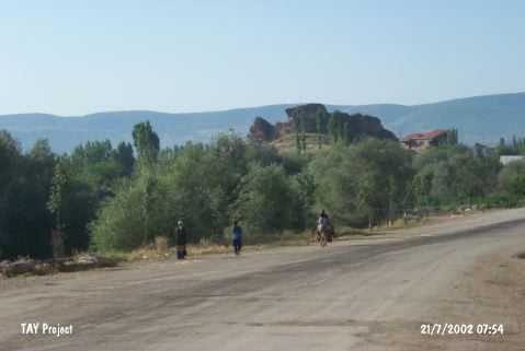 |
|
Type:
|
Mound |
|
Altitude:
|
710 m |
|
Region:
|
Black Sea |
|
Province:
|
Yozgat |
|
District:
|
Aydincik |
|
Village:
|
Kazankaya |
|
Investigation Method:
|
Survey |
|
Period:
|
|
|
|
|
 |
|
| It lies 4 km north of the Çekerek-Alaca motorway; 24 km northwest of Çekerek District as the crow flies; northeast of Yozgat Province. The Çekerek River passes through the village. To the south lies a fertile and watery plain irrigated by the river. There is a second rocky hill separated by a deep valley; south of the Saribaba Hill; southeast of the village. Besides Göktepe; it is also called Ridvankaya or Rifat Tepe. It overlooks the river; the plain and the strait. The brilliant observation point surrounded by a wall could be where the ruler was residing or a garrison. It was investigated during the excavation of the Kazankaya cemetery by the excavation team of Masat Höyük. It is suggested by Özgüç that the site had been inhabited during the second half of the second millennium BC. Dishes; teapots and sherds of pithos were collected from the surface. They are washed in red brown and burnished. The paste of the thick walled deep jug is coarse. The settlement can be related to the cemetery of Kazankaya. |
| Location: |
| Geography and Environment: |
| History: |
| Research and Excavation: |
| Stratigraphy: |
| Small Finds: |
| Remains: |
| Interpretation and Dating: |