|
©The Archaeological Settlements of Turkey - TAY Project
|
|
|
|
|
|
Gökhöyük |
|
|
For site maps and drawings please click on the picture... 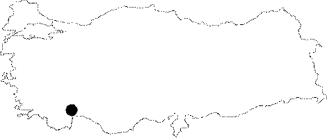 |
For photographs please click on the photo... 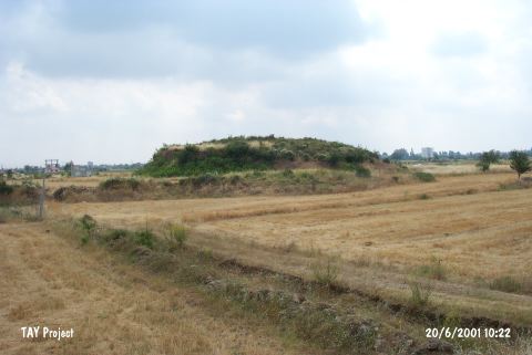 |
|
Type:
|
Mound |
|
Altitude:
|
290 m |
|
Region:
|
Mediterranean |
|
Province:
|
Antalya |
|
District:
|
Merkez |
|
Village:
|
Yeniköy |
|
Investigation Method:
|
Excavation |
|
Period:
|
|
|
|
|
 |
|
| It lies in the Dösemealti Plain; 4 km south of the Karain Cave; 20 km north-northwest of Antalya Province. It was discovered by K. Kökten. It stands on a travertine structure. Since it had been severely damaged due to a water channel constructed in 1984; it was excavated by the Antalya Archaeological Museum in 1986. The sections 5-6 m high resulted from the destruction were excavated. In lower levels of those sections; burnt mud brick and stone remains were uncovered. Black burnished ware; ring-handled vessels; red burnished jugs and dark brown ware and sherds of pithos were collected from those sections. Finds collected during the excavations are preserved in the prehistoric section of the Museum while some are on the exhibition. Handles of brushes in terra cotta; pins and spearheads in copper and bronze were recovered. The characteristics of the pottery ware are compared with the Karatas/Semayuk wares. It is illustrated as Gökhöyük in the 1:200.000 map. The excavation finds were not been published in detail. It takes place in the registered archaeological sites list prepared by Ministry of Culture and Tourism. |
| Location: This site lies northwest of the city of Antalya; 1 km northwest of the town of Yeniköy; west of the old Antalya-Burdur highway and 2.5 km southwest of the village of Yalnizköy. |
| Geography and Environment: This mound site lies in the travertine plain at the foot of Mount Katran. It has been reported that the height of the mound is between 5-6 m. The site was partially destroyed as a result of canal construction in 1984. |
| History: |
| Research and Excavation: |
| Stratigraphy: |
| Small Finds: |
| Remains: |
| Interpretation and Dating: |