|
©The Archaeological Settlements of Turkey - TAY Project
|
|
|
|
|
|
Gökçeler |
|
|
For site maps and drawings please click on the picture...  |
For photographs please click on the photo... 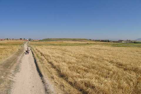 |
|
Type:
|
Mound |
|
Altitude:
|
1000 m |
|
Region:
|
Aegean |
|
Province:
|
Kütahya |
|
District:
|
Altintas |
|
Village:
|
Gökçeler |
|
Investigation Method:
|
Survey |
|
Period:
|
|
|
|
|
 |
|
| It lies 400 m southeast of Gökçeler Village; northwest of Altintas District; south of Kütahya Province. It is located to the southeast of the village cemetery . To its west flows a stream. It was discovered by T. Efe during a survey conducted in the region in 1991. It is the biggest mound of the region. It measures 17 m in height and 250 m in diameter. Materials of the Phrygian and Classical Periods are rich on the surface. Only two small sherds are dated to EBA. Another surface collection is necessary to attest the EBA settlement. It takes place in the registered archaeological sites list prepared by Ministry of Culture and Tourism. |
| Location: |
| Geography and Environment: |
| History: |
| Research and Excavation: |
| Stratigraphy: |
| Small Finds: |
| Remains: |
| Interpretation and Dating: |