|
©The Archaeological Settlements of Turkey - TAY Project
|
|
|
|
|
|
Ayanis |
|
|
For site maps and drawings please click on the picture... 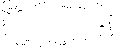 |
For photographs please click on the photo...  |
|
Type:
|
Fortress |
|
Altitude:
|
m |
|
Region:
|
Eastern Anatolia |
|
Province:
|
Van |
|
District:
|
Merkez |
|
Village:
|
Agarti |
|
Investigation Method:
|
Excavation |
|
Period:
|
Middle Iron Age |
|
|
|
 |
|
| Location: It lies 500 m north of the Agarti Village, 300 m far from the Lake Van, 38 km far from the provincial center of Van. |
| Geography and Environment: It was founded on a hill strecthing in the east-west direction. It is 150 m wide, and 400 m long. It is 225 m high above the Lake Van, and 1866 m high above the sea level. |
| History: |
| Research and Excavation: The excavations at the Ayanis Fortress has been conducted by a team under the direction of Altan Cilingiroglu, Near Eastern Archaeology Department, Literature Faculty of the Aegean University since 1989. The team consists of Zafer Derin, Esref Abay, Haluk Saglamtimur, Özlem Çevik, Aylin Ü. Erdem, Atilla Batmaz and Fulya Dedeoğlu of the Aegean University; Ingret Reindell and Mirjo Salvini of Rome, and Oscar White Muscarella of the New York Metropolitan Museum. In 1997, Elizabeth Stone of the New York Stony Brook University, and Paul Zimansky of the Boston University participated in the excavation team. Since then, the excavations have been carried out in two different sections as "Citadel" and "Outer Town". Since 2014, excavations at Ayanis Fortress have been conducted under the direction of Mehmet Isikli. |
| Stratigraphy: The excavations at the Ayanis Fortress yielded two building levels; Middle Age and Middle Iron Age (Urartu). |
| Small Finds: Fortress: Based on two Byzantine coins uncovered, the Middle Age level is dated to the 11th century AD. Fortification walls on the southern slope of the fortress represent the most significant architectural remains of the Ayanis Fortress. These walls were built with andesite stone blocks of 0.80-0.60 m. The superstructure is of mudbrick. More than 100 bronze arrowheads were found in front of the southern fortifications. Limestone blocks of 0.50-0.60 m were used for the construction of 100 m long eastern walls. The monumental gate of the fortress is on the southeastern corner of the fortifications (Area V). The gate is almost 4 m wide. The gateway was paved with andesite stone blocks. The iron latch found in 1993 should have been used to close the wooden wings of the gate. One of the most significant finds in this area was a building inscription uncovered in front of the monumental gate. The inscription is 0.44x0.59x0.18 m in size, inscribed on an andesite stone. It consists of 14 lines, referring to the name of the king who constructed the fortress (Rusa-II, son of Argisti II) and the fortress (Rusahinili in front of the Mount Eiduru). The excavations in the "Storage Rooms or Magazine Areas" (Area VII) on the southwestern section of the fortress yielded more than 115 pithoi. Near the rims, they have cuneiforms and hieroglyphs, which provide information on the quantity and type of contents in pithoi. Another significant find in this area is a 2.20 m long stone channel, which was probably used for distribution of grains and liquids. The most significant finds of the fortress were uncovered at the Area VI, which was called the "Pillared Hall", yielding many bronze and iron nails, spearheads, arrowheads, shields, helmet and swords in bronze. Some of them are inscribed, indicating dedications to the God Haldi. In 1997 a bronze shield with a lion head, one of the most significant finds of the Urartian art, was uncovered here. Although such shields have been long known from the Khorsabad relief, it was the first one unearthed during the excavations. The shield has a diameter of 1 m, decorated with lion and bull motifs. The inscription on the edge of shield indicate that it was dedicated to the God Haldi by Rusa II, son of Argisti II. The same campaign yielded andesite walls of a temple in this area. The Urartian inscription on the andesite stones on the façade of the temple represents the longest inscription of the Urartian history following the inscriptions of Horhor Royal Tomb and Analikiz. With an overall lenght of 16 m, it was studied by Mirjo Salvini. According to the inscription, the Urartian king Rusa II took slaves from the land of Hate, Mushki and Assyria, and built a city and garden around the Ayanis Fortress. In 1998, the cella of the temple was excavated, exposing an alabaster platform opposite to the entrance of the temple. The platform was decorated with incised sphinx, lion and fantastic bird motifs. The andesite walls of the cella were decorated with motifs using stone-engraving (intaglio) technique, an unusual technique in the Urartian art. The excavations have concentrated on the southern slope of the fortress since 1999. Many bronze and iron weapons including spearheads, arrowheads, bronze quivers, shields and helmets were unearthed in the storage rooms of the temple area on the southern slope between 1999 and 2002. In addition to bronze and iron objects, a tin plated shield and helmet were found in the southern storage rooms during the 2001 campaign. Both are inscribed with a dedication to Haldi by Rusa II. Such tin plated weapons are presumably ceremonial, and were offered or gifted to the temple for hanging on the walls and pillars. Another significant find unearthed at the Ayanis Fortress is a bronze cauldron found in situ in the passageway between the temple area and storage rooms in 2002. With a rim diameter of 1 m, it has two handles, and it was filled up with millet. The 2005 excavations yielded a pillared hall. Besides, a storage room was found that was identified as "Magazine nr 9" [Çilingiroglu-Erdem 2007:125]. During the excavations in 2006 performed in the east buildings at section VII different buildings than previously unearhed were found east of magazine 9 and these were named "eastern buildings". Architecture from two different periods, Medieval Age and Urartu were identified at the excavated section. Three separate buildings that were dated to Urartu Period were unearthed in scales from north to south. It was found that the section nr IX is a rectangular patio consisting of rectangular butresses, covering an area between the west wall and the East Magazines. As a result of the excavations at section XI, buildings 2, 4, 5 and 6 were unearthed in full [Çilingiroglu-Erdem 2010:1-6]. A section enumerated as 3 was found south of East Buildings at section VII in 2007. Stairs provide access to the room. Beams and fire level identified in section IX are thought to belong to the roof construction between south wall and buttresses' wall which also forms the upper structure of the building below. Identified were; two silos in front of the north wall of the building named 7 in section XI, two platforms in front of the east wall, a hearth in southeast corner, a platform in front of the south wall, grindstone in front of the west wall, a platform for the mortar, and a division where the produce from the south of the platform was stored. There is a hearth formed by the lenger pieces of external contours in the northeast corner of the revealed building nr 8. Building 9 unearthed west of building 8, has adobe walls, lies in southeast-northwest direction and has rectangular plan [Çilingiroglu-Erdem 2010:7-11]. In 2008 a building named magazine 10, that went through a fire disaster was found in section VII. Pretty large size burnt beams were found particularly more frequently on the southeast side of the level that went through fire. Following the excavations on the floor north of the building it was found that the building level was characterized by the bedrock and the surface of the bedrock was plastered to make it look smooth. Presence of an Urartu adobe wall measuring 2.5 cm wide lying east-west with a plastered smooth surface was ideintified west of magazine 10. The building named 10, located in section XI, has two doors. An architectural find that may be characterized as an insitu rectangular washbasin made of chalk stone, and plastered with clay, with a discharge hole in the corner was found in the northwest corner. West of this building the north wall of a building named 11 was found [Çilingiroglu-Erdem 2010:13-18]. The 2009-2011 excavations were carried out in several areas. The 2012 campaign, on the other hand, concentrated on the restoration and determining of the damage caused by the earthquake taken place in 2011. During the excavations conducted in the West Sector in the area no.VII, two rooms extending in the north-south direction were exposed. The room no.1 is a magazine with high mud brick walls and it measures about 3x66.5 m. To the west of the room, two doors facing each other are located. The doors are 1 m in width. One of these doors opens to the room no.2. The other door, on the other hand, gives access to the rooms in the southwest. The room no.2 is located in the east of the room no.1. The room was separated from the room no.1 by a common wall. It measures about 3.5x7 m. To the northwest of the room, an entrance corridor with a width of 1 m and a length of 2.5-3 m locates. The room is also accessible from the room no.1 and the magazine no.10 in the northeast. During the excavations conducted in the South Sector, a magazine with a dimension of 3.5x10 m was unearthed in the south of the magazine no.10. It was determined that the remains belonging to the Middle Age have damaged the Urartian structures (especially the ones in this area). 6 storage jars were placed on the floor of the magazine. In the area no.IX, the excavations were carried out in order to expose the rest of the Pillared Hall, pottery depots and other architectural remains. The pottery depots unearthed in this area sat on the bedrock. These depots consist of basement stories with 6 m high walls. As a result of the excavations in the Pillared Hall, it was determined that the plastered walls of the structure were painted in blue and brown. The remains of plaster recovered from the area bear decoration as well. The structure is entered through the door with a width of 1.90 m in the south wall. The beams belonging to the upper part of the door and the stones that were used for tightening up the beams were found in situ. In the area no.XI, the studies were conducted in the rooms no.12, 13,14 and 15. The rooms no.13 and 14 are the pottery depots. The rim of the bronze bowl found in the room no.15 reads as "The property of Rusa, the son of Argishti". Remains of a structure were unearthed in the area no.XII that is located in the east of the south city walls and the west of the Monumental Gate. The current measurements of the room are 5.50x9.60 m. The thickness of its walls is 2 m and the height ranges from 4 m to 6 m. It has mud brick walls erected on stone foundation. The stone foundation was sat on the bed opened into the bedrock. The door providing access to the room has not yet been found. The remains of plaster found in the room indicate that the walls were painted in blue and brown. It was observed that the sherds belonging to the storage jars recovered from the room bear remains of carbonized grain. A layer consisting of carbonized barley and wheat remains was exposed especially at the bottom of the walls and in front of the northern trench wall. This layer with a thickness of about 0.15 m suggests that the room may have been used as a grain depot. The excavations in the area no.XIII yielded remains of a mud brick wall extending in the northwest-southeast direction. In the west section of the trench, another wall with a width of about 1.70 m was found. This wall cuts the wall extending in the northwest-southeast in right angle and both faces of the wall were plastered [Çilingiroglu-Batmaz 2014]. Outer Town: The settlement outside the citadel (Outer Town) covers an area of ca. 198 acres based on the distribution of sherds. The excavations continue since 1997 including: 1) The area surrounding the citadel was arranged in squares of 50x50 m, and 40 liter soil sample were taken from these squares so that distribution of sherds was determined. 2) A chosen area of ca. 62 acres around the citadel was surveyed by magnetometer method, which resulted in better outcomes, exposing evidence of both domestic and public buildings. 3) The excavation at the Outer Town covered a total area of 2700 squaremeters. The architectural remains revealed on the northern, eastern and southern sections of the fortress probably belong to public buildings. Many residential structures were unearthed on the slope so called Güneytepe to the east of the fortress. The public buildings, which are characterized by a well-planned architecture cut deep into the bedrock have exterior buttresses while one has pillars which supported the ceiling of the room. In the area known as Pinarbasi to the north of the fortress, very limited number of artefacts were found although a bulla with seal impression was uncovered here. The ceramics unearthed in this area are mainly medium or coarse wares with simple forms. Some sherds, possibly dating to the post-Urartu Period, were found inside the public building. Roughly 30 acres of the Güneytepe slope were allocated for residential buildings. Current evidence suggests that the earliest structures in this area are large and square houses, which are located in the mid-section of the slope facing the citadel. Their ground plans are as large as 200 squaremeters, and they have regular stone walls reinforced with a mudbrick superstructure. In 2002, a water depot was uncovered in the Outer Town. It was observed that the structures unearthed at Diskent in 2005 were installed on top of the bedrock in parallel with the general Urartu architecture character [Çilingiroğlu-Erdem 2007:128]. During 2007 excavations three stone foundation buildings were found in three separate trenches [Çilingiroglu-Erdem 2010:12]. The excavations that unearthed the street in 1999 were resumed in 2008, the walls delimiting the street were unearthed. Presence of more than one small building was identified in this section and due to the large vessels and pithoi these were thought to be storage rooms [Çilingiroglu-Erdem 2010:18-20]. The City Wall: In 2014, the excavations were carried out in the South City Wall and the North Slope City Wall. The South City Wall Excavations: The city wall has a foundation built with 2 m basalt blocks and it has a mud brick body wall that reaches up to 6 m high. This city wall is the best-preserved example of the Urartian military architecture. The fact that the section of the city wall can be easily seen provides us more information about Urartian city wall architecture. The wall was plastered within the scope of restoration and conservation studies. The mortar comprises of %9 straw, %40 sieved soil, and %51 water. The North Slope City Wall Excavations: After removing the eroded soil, a cultural layer consisting of animal bones and traces of an immense fire was reached. Based on the sections, it is possible to say that this layer flows along the north slope. Fragmented bronze objects, pottery sherds in good quality, carbonized wooden pieces, a bulla with cuneiform, a cylindrical seal and a very thin limestone object (a button?) in good quality were recovered from this layer. Since the studies yielded preliminary results, it is not yet possible to comment on architecture. Only, the traces of regular mud brick block were detected. However, it is not yet known whether these blocks belong to the city wall or the upper structure [Isikli-Özdemir 2016:277-280]. Temple: In 2014, the studies were carried out in the Temple Area in which the Temple of Haldi is located. The mud brick architecture were plastered as a part of conservation studies. The temple area that is located in the center of the citadel was dominantly built with mud brick. This architecture has been damaged due to the rough climate of the Eastern Anatolia region. The 3 m wide entrance of the temple was collapsed and formed an arch and this section filled with mud brick blocks. In this area, the excavations were conducted in order to detect a possible monumental entrance belonging to the temple area. As a result of these studies, a monumental entrance that was painted and plastered in patches was found. The existence of a single course of a wall brings these questions to mind: how this entrance was used and what was its function. This monumental entrance possibly opens to a saloon-like large room. Some parts of this rom were exposed and solid, compacted earth floor was reached. The studies carried out in this area yielded a limestone lion head statue, a body fragment belonging to a stylized figurine, stone artefacts with palmette and tree of life motifs, a great number of golden pieces, decorated golden and bronze rosettes, limestone applique fragments, beads, metal objects, stone bowl pieces, and a large number of mosaic fragments. The majority of these finds were recovered from the excavated section of the aforementioned large room. The room probably had a religious and royal importance. The limestone lion head among the finds is the first stone example of the Urartian Art [Isikli-Özdemir 2016:276; 278-279]. Pottery: Well-burnished red ware accounts for 10 percent of the ceramics uncovered, and presence of stamps, which might have been potter's mark, suggests that they are related with the citadel rather than the public buildings in the Outer Town. Thirty pithoi were unearthed inside magazine nr 9 during 2005 excavations. All pithoi contain remarks made with cuneiform, showing their capacities [Çilingiroğlu-Erdem 2007:125-126]. A small amount of Urartu pottery in the east buildings at section VII, a trefoil mouthed jug filled with grains, over one thousand sherds at section IX, jugs some of them which are in situ in the residential area at section XI, 2 large size jars, a red burnished dish, many pithoi were found during 2006 excavations [Çilingiroglu-Erdem 2010:1-6]. In 2007 a find group of sherds were identified in section IX. 2 jars, 17 pots, 3 jugs and 2 bowls were found in building 7 at section XI, many pots were found in the wes wall of building 8, 2 pots in the east wall, 6 intact vessels, 2 almost intact vessels and 2 ceramic bottles were found in building 9 [Çilingiroglu-Erdem 2010:7-11]. Small Finds: Common finds include flat, iron arrowheads of an unfamiliar type for the fortress, pigment fragments in "Eygptian blue", and tools and objects in bronze and iron. Among the most important finds recovered from the buildings are an incised bulla and two decorated fragments in bronze. The 2002 excavations yielded 2 bronze cauldrons in structure no. 7. These cauldrons which were found for the first time at Ayanis have a special importance as they differ from the usual finds. In 2005, seven fragments of terracotta bulla, two broken and partly missing terracotta figurines, blue painted wall decorations, an iron axe and two bronze nails were found. Furthermore, two swords in bronze and iron, and a hilt in the "animal style" were uncovered [Çilingiroğlu-Erdem 2007:126-127]. During 2006 excavations, a bronze lock mechanism was found in one of the east buildings at section VII, as well as an iron nail, amorphous bronze and iron objects, two iron arrowheads, an amorphous iron object assumed to have been a sickle, many iron arrowheads, spear heads, bronze arrowheads, bronze tweezers were found at section XI [Çilingiroglu-Erdem 2010:1-6]. In 2007 iron arrowhead, bronze jug, sandstone, pestle, oil stone, stone vessel, fragment of a wooden vessel, iron shovel, iron axe, textile specimen, bronze quiver were found in building 7 of section XI, 5 seals, bronze fibula, bronze ring, bone and agate beads, 1 grinding stone, 1 iron arrowhead, 1 iron spearhead, 1 iron blade, touched bone inside a jug on the west wall, 1 oil stone 1 sand stone and 1 oillamp on the east wall, in building 8, wooden vessel fragments 2 sand stones, 1 pestle, bronze fibula, brace fragment, bone seal, 200 bone beads, bronze beltbuckle fragment, 1 iron blade, 1 bone seal and 1 bronze helmet were found in building 9 [Çilingiroglu-Erdem 2010:7-12]. Human Remains: A rectangular planned grave room with stıone walls was unearthed at Diskent in 2006. A human skeleton facing south lying northeast-southwest was found inside the burial. The burial gifts consisted of 17 bronze earrings, a bronze belt around the waste of the skeleton, and a red burnished Urartu trefoil jug west of the skeleton [Çilingiroglu-Erdem 2010:6-7]. |
| Remains: |
| Interpretation and Dating: Seemingly built by the Urartian King Rusa II, the Ayanis Fortress was completed in 651 BC. Ayanis should have been the last fortress built by Rusa II. The excavations revealed that there was at least two building levels at the citadel, and it was reused for a period of time after undergoing repairworks following the fire. When these levels are taken into consideration, it seems that the Ayanis Fortress should have maintained its presence during the Urartu Period until 645 BC. The excavations revealed that the citadel had been also inhabited during the Middle Age. |