|
©The Archaeological Settlements of Turkey - TAY Project
|
|
|
|
|
|
Asik Hüseyin Kalesi |
|
|
For site maps and drawings please click on the picture... 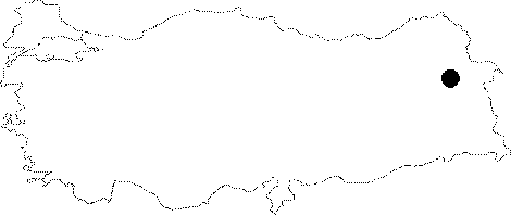 |
For photographs please click on the photo...  |
|
Type:
|
Fortress |
|
Altitude:
|
m |
|
Region:
|
Eastern Anatolia |
|
Province:
|
Agri |
|
District:
|
Dogubayazit |
|
Village:
|
|
|
Investigation Method:
|
Survey |
|
Period:
|
Middle Iron Age Early Iron Age |
|
|
|
 |
|
| It lies 6 km east of the Abbas Lake as the crow flies, 13 km northeast of the Balik Lake in the Dogubayazit District of Agri. It rests on two rocky hills, which are connected to each other by a low saddle. The fortifications are mostly extant. Also rock signs and a cemetery area with Urartian features are seen. While the fortress bear Urartian features, sherds recovered from the cemetery area have characteristics of the Early Iron Age. |
| Location: |
| Geography and Environment: |
| History: |
| Research and Excavation: |
| Stratigraphy: |
| Small Finds: |
| Remains: |
| Interpretation and Dating: |