|
©The Archaeological Settlements of Turkey - TAY Project
|
|
|
|
|
|
Gedikören |
|
|
For site maps and drawings please click on the picture...  |
For photographs please click on the photo... 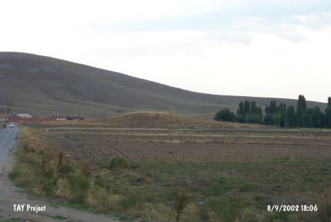 |
|
Type:
|
Mound |
|
Altitude:
|
1125 m |
|
Region:
|
Central Anatolia |
|
Province:
|
Konya |
|
District:
|
Ilgin |
|
Village:
|
Gedikören |
|
Investigation Method:
|
Survey |
|
Period:
|
|
|
|
|
 |
|
| Located in the graveyard of Ilgin Lake north of Gedikören Village; the medium mound; measuring 10 m in height and 50 m in diameter; lies northwest of Konya; 8 km north of Ilgin. It was discovered during the 1994 survey conducted by H. Bahar. Chalcolithic Age and EBA ceramics were collected from the surface. Bahar groups the sherds according to formal characteristics rather than the ware types. It takes place in the registered archaeological sites list prepared by Ministry of Culture and Tourism. |
| Location: |
| Geography and Environment: |
| History: |
| Research and Excavation: |
| Stratigraphy: |
| Small Finds: |
| Remains: |
| Interpretation and Dating: |