|
©The Archaeological Settlements of Turkey - TAY Project
|
|
|
|
|
|
Gavurini Magarasi |
|
|
For site maps and drawings please click on the picture... 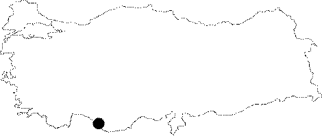 |
For photographs please click on the photo... 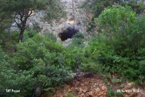 |
|
Type:
|
Cave |
|
Altitude:
|
1140 m |
|
Region:
|
Mediterranean |
|
Province:
|
Antalya |
|
District:
|
Alanya |
|
Village:
|
Obaköy |
|
Investigation Method:
|
Excavation |
|
Period:
|
|
|
|
|
 |
|
| Location: This cave-site is in Obaköy Village; which is 3.8 km from the town center of Alanya; southeast of the city of Antalya. The cave is located in a deep valley on the Gömerme Hill in Kadipinari Mevkii. This valley is to the northeast of Oba stream and Yayla-Degirmendere road. It is also known as Kadipinari/Kadiini cave due to its location but the local name is Gavurini. |
| Geography and Environment: The cave; which has a ceiling height of 10-20 m; is pretty large and deep. The big rocks in the entrance do not block the entry. It is 50 m high from the road. |
| History: |
| Research and Excavation: Kökten opened a test trench by the entrance of the cave in 1956-57. The top layers of the excavation yielded Hellenistic material which overlay Early Bronze Age deposits. Beneath this were Neolithic layers as well as some Upper Palaeolithic strata. Since virgin soil was never reached we are not certain whether the Upper Palaeolithic is the earliest cultural deposit at the site. The stratigraphy should not to be trusted because the size of the test trench was very small. Later in 1996 the cave was visited by E. Güleç; S.L. Kuhn; A.Sevim and C. Pehlevan during a survey in Antalya region. |
| Stratigraphy: |
| Small Finds: In this cave; which was discovered and investigated by Kökten; ceramic sherds that could belong to EBA were found. According to these finds; it is suggested that this cave was a habitation site in the EBA. In the fieldwork done in the cave during TAYEx; materials were not seen because of the intense vegetation. |
| Remains: |
| Interpretation and Dating: |