|
©The Archaeological Settlements of Turkey - TAY Project
|
|
|
|
|
|
Gavur Tepe |
|
|
For site maps and drawings please click on the picture...  |
For photographs please click on the photo... 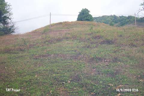 |
|
Type:
|
Mound |
|
Altitude:
|
390 m |
|
Region:
|
Black Sea |
|
Province:
|
Sinop |
|
District:
|
Erfelek |
|
Village:
|
Kazmasökü |
|
Investigation Method:
|
Survey |
|
Period:
|
|
|
|
|
 |
|
| It is located within the territory of the Meydan Quarter; 1 km northeast of Kazmasökü Village; 2 km southwest of Mescitdüzü Village; 10 km west of Erfelek. It was discovered in 1987 during the Sinop Survey conducted by M.A. Isin. It was investigated by S. Dönmez in 1998. M.A. Isin reports that it measures 100x70 m in dimensions whereas Dönmez reports it as 90x60 m in dimensions and 10 m in height. Materials of the EBA; the Late Phrygian and Roman Periods were collected from the surface. EBA pottery is tempered with grit and plant. Forms of bowls and dishes were recovered. It takes place in the registered archaeological sites list prepared by Ministry of Culture and Tourism. |
| Location: |
| Geography and Environment: |
| History: |
| Research and Excavation: |
| Stratigraphy: |
| Small Finds: |
| Remains: |
| Interpretation and Dating: |