|
©The Archaeological Settlements of Turkey - TAY Project
|
|
|
|
|
|
Pinarcik |
|
|
For site maps and drawings please click on the picture... 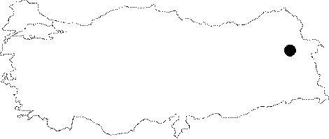 |
For photographs please click on the photo...  |
|
Type:
|
Cemetery |
|
Altitude:
|
m |
|
Region:
|
Eastern Anatolia |
|
Province:
|
Agri |
|
District:
|
Dogubayazit |
|
Village:
|
Pinarcik |
|
Investigation Method:
|
Survey |
|
Period:
|
Early Iron Age |
|
|
|
 |
|
| It is situated at an altitude of 2300 m on the southwestern slopes of a hill to the southeast of the Pinarcik Village in the Dogubeyazit District of Agri. It lies 5 km south of the Sinek Upland. Two portal dolmens topped by flagstones, which were previously disturbed with illicitly diggings were found. There lies another necropolis area to the southeast of the site. Based on the graves disturbed by the treasure hunters, the graves have a rectangular plan, the side wall built using corbelling technique and topped with large flagstones. No sherds were found in or around the grave chambers. The site bears characteristic features of the Early Iron Age. |
| Location: |
| Geography and Environment: |
| History: |
| Research and Excavation: |
| Stratigraphy: |
| Small Finds: |
| Remains: |
| Interpretation and Dating: |