|
©The Archaeological Settlements of Turkey - TAY Project
|
|
|
|
|
Durusu Kalesi |
|
|
|
|
|
For site maps and drawings please click on the picture...  |
For photographs please click on the photo... 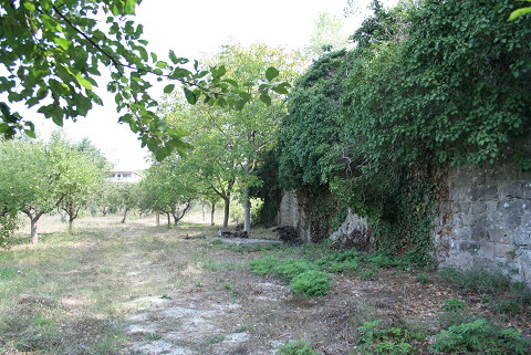 |
|
|
|
|
Type:
|
Fortification |
|
Plan Type:
|
|
|
Year of Costruction:
|
|
|
Phase:
|
Late |
|
Investigation Method:
|
Survey |
|
Altitude:
|
10 |
|
|
|
|
Region:
|
Marmara |
|
Province:
|
Istanbul |
|
District:
|
Çatalca |
|
Village:
|
Durusu |
|
Antique Name:
|
Delkos |
|
|
|
 |
|
| The wall remains are situated to the west of Terkos Lake inside the land nr. 1 on Kaleiçi Avenue at Cami Quarter projecting like a peninsula into the Terkos Lake in the Durusu County of the Çatalca District in Istanbul Province. were investigated by M.H. Sayar, who conducted surveys in the region. The city walls which were heavily destructed because of illicit diggings were originally built with a couple of courses of bricks and mortar up to the water level of the lake. Another wall at the other end of the street also stretches into the lake. It belongs to a later period, probably to the Byzantine Period. Based on the Byzantine finds in the peninsula and the ancient sources and inscriptions, it is suggested this settlement may be identified with Delkos, known to be on the shore of the Terkos Lake. It almost vanished entirely at present due to housing [Sayar 2002:101-102, pic. 5; Sayar 2006:14]. The west wall of the fortress is approximately 200 m long ending at the lake. It connects with the present day north wall in the section where an annex lies inside the land of the fortress. The north wall is approximately 8 m in east direction. The west wall was demolished for about 43 m after advancing for approximately 1.5 m from the corner that it composed with the north wall. The walls can be traced at foundation level on this demolished section. After the demolished section the west wall can be traced without interruptions, and its length is 131 m to the lake. The west wall continues 10 m from the shore and in two pieces inside the lake. The wall height is approximately 6-7 m. Small, irregular stones and limestone mortar were used [TAYEx 18.08.2008]. |
| Location: |
| Geography and Environment: |
| Research and Excavation: |
| Description: |
| Finds: |
| Interpretation: |
| Destruction: A large portion of the fortress did not survive due to destruction by illicit diggings and natural causes. Agricultural plantations are around the fortress. Besides, some walls pertaining to the fortress were destroyed by housing. The remaining walls are destructed due to a thick layer of vegetation. Besides, there are water pumps placed on the walls for irrigation. The demolished sections of the walls were repaired using bricks and concrete [TAYEx 18.08.2008]. |